This new app is fantastic for getting around New York using the subway. It contains a clear and colourful map, doesn't need an internet connection so works anywhere and has some totally unique features.
● KEY FEATURES ●
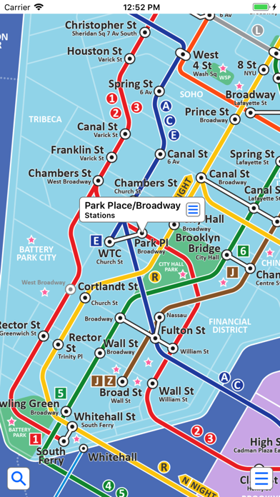
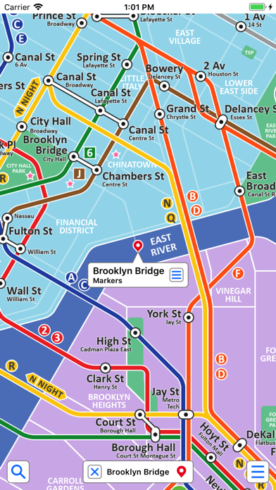
● Colourful clear map with major geographical features and places of interest.
● View the map, look up places of interest, plan your journey, etc all without an internet connection.
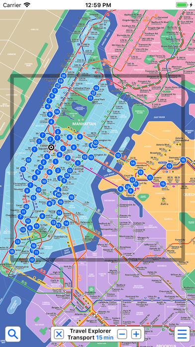
● Unique "Travel Explorer" feature provides a view of travel times and distances to any location on the map.
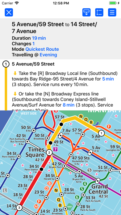
● Clear route text itinerary with step by step instructions.
● Save and recall favourite and recent journeys.
● Easily locate your nearest transport stop.
● Take me home feature.
● Online street map integration (internet connection required).
● View live train departure boards and service advisories (internet connection required).
● OVERVIEW ● The New York Subway - Map and route planner by Zuti makes it easy to travel in and around New York using the subway, Staten Island railway, Staten Island ferry and JFK Airtrain. The application contains a professionally drawn map and route planner with many unique features. The map provides a simple and colourful view of the city transport services with the ability to switch to an online street map view when an internet connection is available. This provides the best of both worlds, the transport map and route planning anytime, anywhere and the online street map and extended search when a connection is available.
● TRAVEL EXPLORER ● The unique travel explorer feature provides a view of travel times using transport or on foot and distances to any location on the map. This is helpful for getting a sense of scale and connectivity of the transport system and can provide some interesting results. For example is it quicker to use the subway to go from Harlem/7 Avenue to 155 Street/8 Avenue or is it quicker on foot? (Hint, the quickest route will keep you fitter). No other application makes it so easy to get around on the subway and allow you to make travel decisions based on the actual distances and estimated travel times on foot.
● ROUTING ● The application does not require an internet connection and will always be available to display a clear and detailed view of the city transport system, plus list and animate the optimum route for your journey. It also provides the fastest route calculations of any mobile routing application (virtually instantaneous) using published journey times and the ability to select the quickest route or the route with the fewest changes.
Comprehensive details of your planned route are shown, including “direction”, “towards” and “service frequency” information (not available on any other offline journey planner) for example “Take the 3 7th Av Express line (Southbound) towards New Lots Av for 17 mins (7 stops). Service runs every 5 minutes” which is essential when finding the correct platform and direction. Also shown are alternatives (if possible) for each leg of the journey.
● NO INTERNET CONNECTION REQUIRED ● The map and routing feature do not require an internet connection and you will not be charged data connection fees. This means the application saves on battery power and runs perfectly underground or on an aeroplane, etc. For international visitors to a city who have data roaming turned off this is an ideal solution.
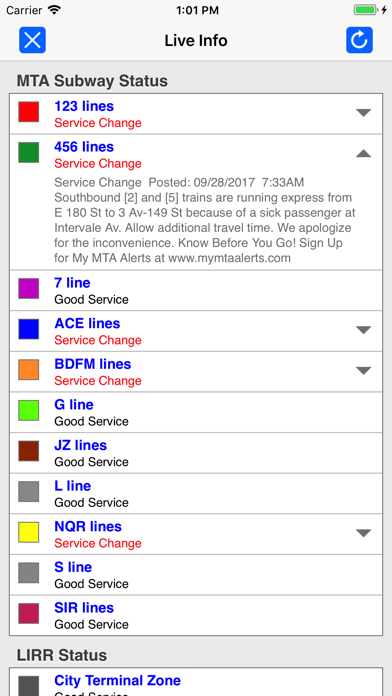
● LIVE INFO ● When an internet connection is available, optional "Live Information" on the current state of the transport services can be viewed allowing you to plan your journeys in advance and avoid any potential delays. Unique to this application is the ability to turn off services that are out of action and automatically calculate an alternative route.
● MORE MAPS ● This map is one in a series of Zuti worldwide city maps, if you like this product you may also enjoy some of our other offerings, please visit www.zuti.co.uk for further information.