アプリオンは、世界のアプリランキングや口コミから、おすすめアプリをまとめている人気アプリ探しサイトです。

PlanARoute [iPhone]

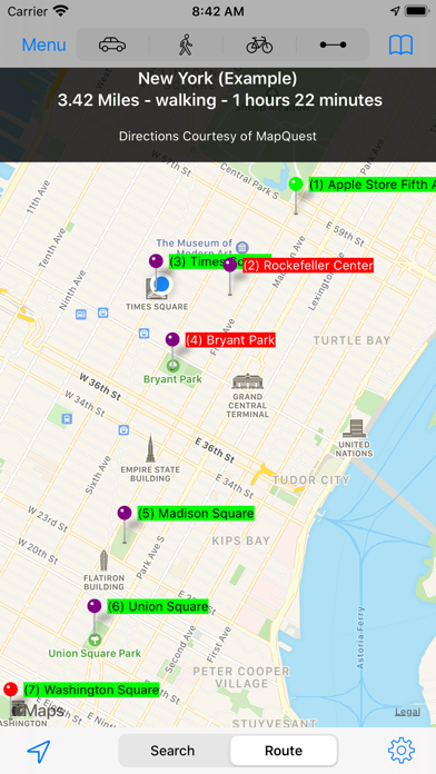
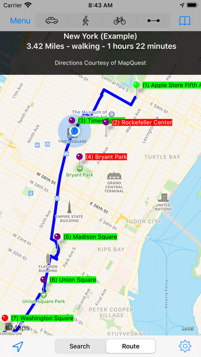
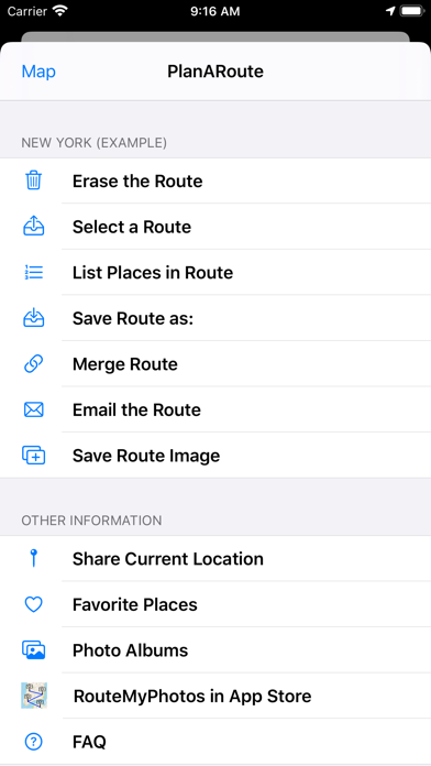
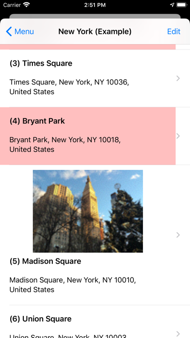
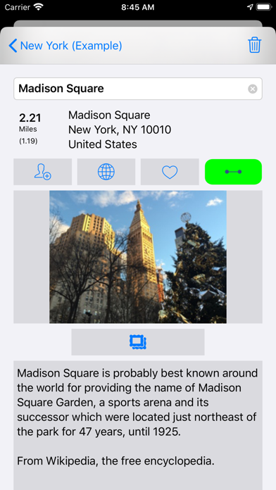
John Kearonが配信するiPhoneアプリ「PlanARoute」の評価や口コミやランキング推移情報です。このアプリには「ナビゲーション」「写真/ビデオ」などのジャンルで分類しています。APPLIONでは「PlanARoute」の他にもあなたにおすすめのアプリのレビューやみんなの評価や世界ランキングなどから探すことができます。
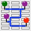
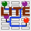
PlanARouteのおすすめ画像1
PlanARouteのおすすめ画像2
PlanARouteのおすすめ画像3
PlanARouteのおすすめ画像4
PlanARouteのおすすめ画像5
PlanARouteのおすすめ画像6
<
>

John Kearonの地図/ナビアプリ

「PlanARoute」は、John Kearonが配信する地図/ナビアプリです。

ナビゲーション 写真/ビデオ

このアプリの話題とニュース

  • 新バージョン6.8.8が配信開始。新機能や改善アップデートがされています。


  • 2012年11月16日(金)にiPhoneとiPad両対応のユニバーサルアプリとしてリリース!


最新更新情報

version6.8.8が、2023年3月20日(月)にリリース

Replaced the Email Route menu option with Export Route menu option. Upon selecting the Export Route menu option, the user will be presented with a choice of three methods of exporting a route to another app or device.

Email format will generate an email consisting of a print out of all the locations in the route, as well as a TXT attachment which can be used to import the route into this app on other devices.

GPX format consists of the Latitude and Longitude (GPS) data of the route, which can be exported to apps that can read GPX data on this device or other devices.

KML format consists of the Latitude and Longitude (GPS) data of the route, which can be exported to apps that can read KML data on this device or other devices.

使い方や遊び方

PlanARoute is a great tool for creating or recording multi-stop driving, walking, cycling or point-to-point routes. More than directions from points A to B, PlanARoute gives you directions from points A to Z.


Use it to plan or record a tour or any other multi-stop journey.


Interested in knowing where you have been but do not want to waste battery power running your device’s GPS? Just take a photo at key points in your journey and PlanARoute will plot on a map those photos and generate a route with addresses, distances and directions from those photos.


Included are two example tour routes (New York and Central Park) which demonstrate the features of PlanARoute. No need to learn complex software. View and play with these example tours to learn how to use this app and use them as a model on how to create your own routes.


Features:


▪ Create walking, cycling or driving routes of up to 26 locations while connected to the internet.
▪ Create point-to-point routes with an unlimited number of locations even when your device is not connected to the internet.
▪ Preserves your privacy by storing your data on your device, not on a website, you have to log into to use. (Data is stored on your device not in iCloud, so try to backup your device periodically).
▪ Sync routes among your devices and the devices of your friends and associates by emailing the route to them.
▪ An unlimited number of routes can be saved and viewed even when your device is not connected to the internet.
▪ Emailed routes have a image of your route, a text description of your route, and both GPX and KML attachments that can be loaded into Google Maps and Earth or GPS devices.
▪ Add locations to a route by touching the map, selecting an address from your Contacts or Favorites library or by typing an address in the search area.
▪ Locations can also be added based upon the location of photos on your device or in iCloud.
▪ View a slideshow from any photos in your route.
▪ Locations can have their order, address and distance displayed on the map.
▪ Locations can be displayed on your map while not being included in your route's path.
▪ Locations can have a photo and note description attached to them and saved into a Favorites library.
▪ Location address information can be added to your Contacts Address book.
▪ The order of locations can be modified or reversed.
▪ Both visual and written directions with distance and time estimates are created for a route.
▪ Distances are measured in miles or kilometers.
▪ The distance to a pin location from your current location can be displayed.
▪ A scale of miles/kilometers is displayed at the top of your map.
▪ A compass and your directional heading can be displayed (iPhone and iPad only).
▪ Standard, satellite, and hybrid maps can be displayed.
▪ Individual Locations can be passed to and opened in Apple Maps or Google Maps (if installed).
▪ If desired, an elevation chart can be created for a route.

最新ストアランキングと月間ランキング推移

PlanARouteのiPhoneアプリランキングや、利用者のリアルな声や国内や海外のSNSやインターネットでの人気状況を分析しています。

基本情報

仕様・スペック

対応OS
12.0 以降
容量
4.8 M
推奨年齢
全年齢
アプリ内課金
なし
更新日
2023/03/20

リリース日
2012/11/16

集客動向・アクティブユーザー分析

オーガニック流入


アクティブ率


※この結果はPlanARouteのユーザー解析データに基づいています。

利用者の属性・世代

アプリ解析デモグラフィックデータ(男女年代比率52%)

・・・だが断るッ!!

デモグラフィックデータを元にユーザー層の性別や年齢分布などを考慮して推定しています。

ネット話題指数

開発会社の配信タイトル

このアプリと同一カテゴリのランキング

浜辺美波 写真集「voyage」
浜辺美波
amazon

John Kearon のアプリ

John Kearon の配信アプリ >

新着おすすめアプリ

新着おすすめアプリ >

注目まとめ

iPhoneアプリまとめ >