アプリオンは、世界のアプリランキングや口コミから、おすすめアプリをまとめている人気アプリ探しサイトです。

UK Parks & Forests GPS OS Maps [iPhone]

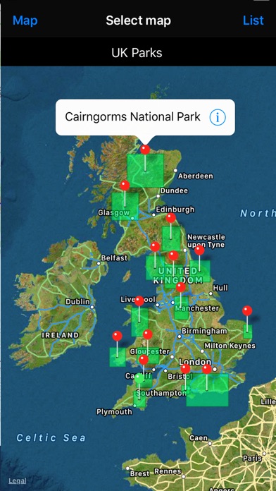
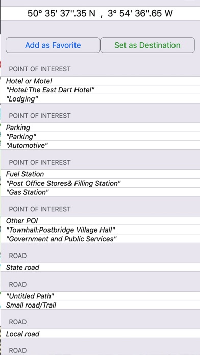
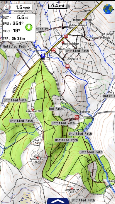
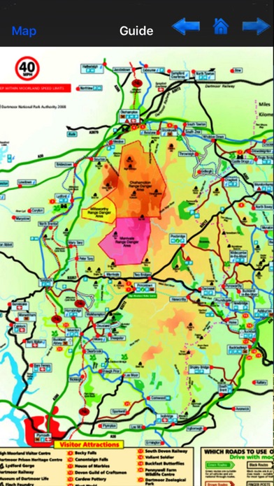
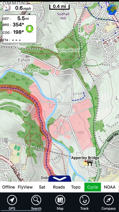
Flytomapが配信するiPhoneアプリ「UK Parks & Forests GPS OS Maps」の評価や口コミやランキング推移情報です。このアプリには「ナビゲーション」「スポーツ」などのジャンルで分類しています。APPLIONでは「UK Parks & Forests GPS OS Maps」の他にもあなたにおすすめのアプリのレビューやみんなの評価や世界ランキングなどから探すことができます。

UK Parks & Forests GPS OS Mapsのおすすめ画像1
UK Parks & Forests GPS OS Mapsのおすすめ画像2
UK Parks & Forests GPS OS Mapsのおすすめ画像3
UK Parks & Forests GPS OS Mapsのおすすめ画像4
UK Parks & Forests GPS OS Mapsのおすすめ画像5
<
>

Outdoor and Topographic charts

「UK Parks & Forests GPS OS Maps」は、Flytomapが配信する地図/ナビアプリです。

ナビゲーション スポーツ

このアプリの話題とニュース

  • 新バージョン4.2が配信開始。新機能や改善アップデートがされています。


  • 2011年2月3日(木)にiPhoneとiPad両対応のユニバーサルアプリとしてリリース!


最新更新情報

version4.2が、2018年3月23日(金)にリリース

このAppはApple Watchアプリのアイコンを表示するようAppleにより更新されました。

Quick Waypoint [QWP]
National Parks updated

使い方や遊び方

!! TRY before BUY !!!
Try now the new FlyToMap web viewer to see all available maps worldwide !!! Visit viewer.flytomap.com


UK Parks map application is extremely advanced contains embedded electronic charts with all information collected from the National Park Service and local sources. The maps contain all multiple trails (Hiking, biking, Stairway trails, Bicycle trails, Equestrian trails etc.,) and Point of interests (POI) like Campgrounds, Eating places, Ranger Stations, Picnic areas, Boat/Canoe launching, Parking areas etc., which are provided depending on the relevant park areas they exists.


“Covers all Trails, Lakes and Rivers within the Parks”
“Covers complete park boundary from (NPS)”
“Elevation Contours with 10 meters interval”
“Mountain Summits”
“All Roads and Railways from TIGER”


PARKS COVERED:
Dartmoor National Park, Exmoor National Park, The Lake District National Park, North York Moors National Park, The Peak District National Park, Yorkshire Dales National Park, Brecon Beacons National Park, Cairngorms National Park, New Forest National Park, Northumberland National Park, Pembrokeshire Coast National Park, Snowdonia National Park, The Broads National Park, Ashton Court Estate - (Bristol), Hyde Park (London).


Features:


GPS
Compass
Tracking (Record & Email)
Add Favorites (Unlimited)
Advanced Search
Search location using Lat/Lon
Check Speed/Distance/Direction towards a destination
Map User Guide
Offline Map
…More…


A Travel guide is provided for easy reference, you can use it without any Active Internet connection!


NOTE:


• Continued use of GPS running in the background can dramatically decrease battery life.


• Turn off GPS when not in use

最新ストアランキングと月間ランキング推移

UK Parks & Forests GPS OS MapsのiPhoneアプリランキングや、利用者のリアルな声や国内や海外のSNSやインターネットでの人気状況を分析しています。

基本情報

仕様・スペック

対応OS
8.0 以降
容量
38.5 M
推奨年齢
全年齢
アプリ内課金
あり
更新日
2018/03/23

リリース日
2011/02/03

集客動向・アクティブユーザー分析

オーガニック流入


アクティブ率


※この結果はUK Parks & Forests GPS OS Mapsのユーザー解析データに基づいています。

アプリ内課金の売れ筋ランキング

  • 1位: Flytomap Pro (300円)

  • 2位: Yorkshire Dales NP - England (400円)

  • 3位: The Peak District NP - ENG (400円)

  • 4位: The Lake District NP - ENG (400円)

  • 5位: The Broads National Park - ENG (400円)

  • 6位: South Downs National Park ENG (400円)

  • 7位: Snowdonia National Park Wales (600円)

  • 8位: Pembrokeshire Coast NP - Wales (600円)

  • 9位: Northumberland NP - ENG (400円)

  • 10位: North York Moors NP - ENG (400円)

利用者の属性・世代

アプリ解析デモグラフィックデータ(男女年代比率52%)

犯人はこの中にいる!

デモグラフィックデータを元にユーザー層の性別や年齢分布などを考慮して推定しています。

ネット話題指数

開発会社の配信タイトル

このアプリと同一カテゴリのランキング

ゆうちゃみ 写真集「ゆうな」
古川優奈
amazon

Flytomap のアプリ

Flytomap の配信アプリ >

新着おすすめアプリ

新着おすすめアプリ >

注目まとめ

iPhoneアプリまとめ >