アプリオンは、世界のアプリランキングや口コミから、おすすめアプリをまとめている人気アプリ探しサイトです。

Flytomap All in One HD Charts [iPhone]

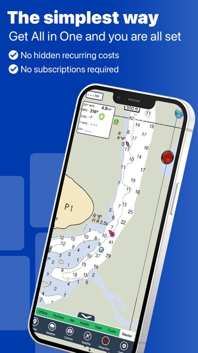
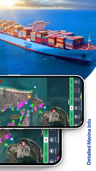
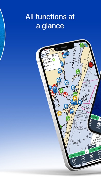
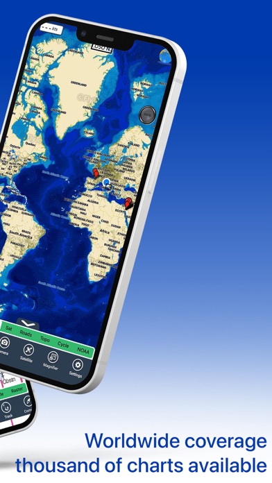
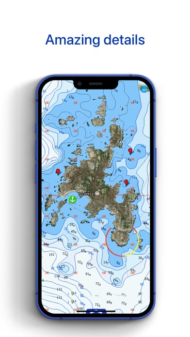
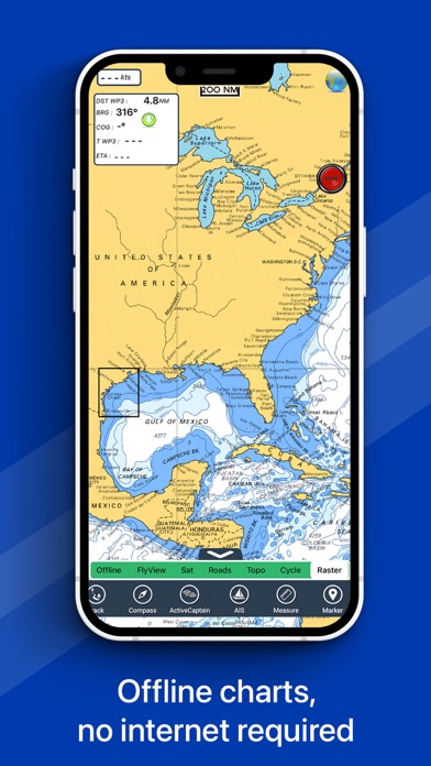
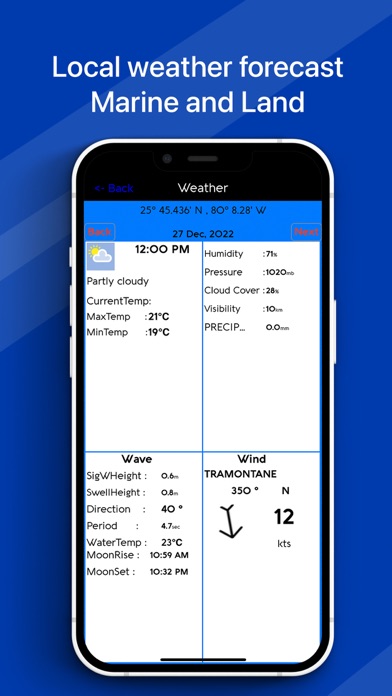
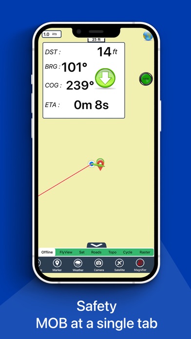
Flytomapが配信するiPhoneアプリ「Flytomap All in One HD Charts」の評価や口コミやランキング推移情報です。このアプリには「ナビゲーション」「旅行」などのジャンルで分類しています。APPLIONでは「Flytomap All in One HD Charts」の他にもあなたにおすすめのアプリのレビューやみんなの評価や世界ランキングなどから探すことができます。

Flytomap All in One HD Chartsのおすすめ画像1
Flytomap All in One HD Chartsのおすすめ画像2
Flytomap All in One HD Chartsのおすすめ画像3
Flytomap All in One HD Chartsのおすすめ画像4
Flytomap All in One HD Chartsのおすすめ画像5
Flytomap All in One HD Chartsのおすすめ画像6
Flytomap All in One HD Chartsのおすすめ画像7
Flytomap All in One HD Chartsのおすすめ画像8
Flytomap All in One HD Chartsのおすすめ画像9
<
>

Charts & Maps GPS Navigator

「Flytomap All in One HD Charts」は、Flytomapが配信する地図/ナビアプリです。

ナビゲーション 旅行

このアプリの話題とニュース

  • 大人の男性スマホユーザーに人気が出てきています。


  • 新バージョン6.5.8が配信開始。新機能や改善アップデートがされています。


  • 2010年7月9日(金)にiPhoneとiPad両対応のユニバーサルアプリとしてリリース!


最新更新情報

version6.5.8が、2023年2月18日(土)にリリース

Charts added:
Albemarle Sound
Apalachee Bay
Bar Harbour
Baton Rouge
Black Bay Houma
Cape Elizabeth to Cape Ann
Central California
Columbia River
Fiji
Florida South West
Georges Bank
Houston
Juan de Fuca Strait
Laguna Madre
Lake Superior West
Long Island South NY
Massachusetts Bay
Oahu-Kauai
Rhode Island Sound
San Juan Island
Upper Chesapeake

使い方や遊び方

FlyToMap™ is a valid and interesting alternative, Benetti Yachts
► The charts downloaded are resident in the app. No internet connection required!
Flytomap All In One HD works on all Apple devices


FlyToMap™ offers a revolutionary app; you can download any chart worldwide (500+) free of charge
Check out your area on viewer.flytomap.com
- All USA Marine charts (US All, East, West, Great Lakes, Major Rivers, Florida, Texas, California, etc.)
- USA Lake Maps 15000+ : Minnesota, Maine, Michigan, Massachusetts, Wisconsin, Texas, California, Florida, Iowa, North and South Dakota...and many more.
- 150+ USA Parks and Forests


- Australia Marine Charts
- Australia Parks
- New Zealand Marine charts


- All Europe Marine Charts
- 200+ major EU Parks
- The world's most famous holiday destinations ie: Caribbean, Seychelles, Mauritius, Maldives, Canary Islands, Azores, Bora Bora, Bali, Oslo Fjord .. and many more.


- Canada Lake Maps: Alberta, Lake of the Wood.. and many more.


► Worldwide Marine and Outdoor Maps available, thanks to viewer.flytomap.com
► Worldwide Satellite images overlay on charts
► Worldwide Terrain features overlay on charts, thanks to Open Street Map, Open Cycle Map, Bing, Earth, GMap
► Interactive Weather forecast
► NOAA raster charts seamless with continuous updates from the official Government server
► ActiveCaptain - Worldwide boaters community, with 200.000 + Captains


Use to Explore:
√ Latitudes and Longitudes to go to your favorite places
√ Search your Favorite points directly
√ Zoom, Rotate and Pan fast just by a finger touch
√ Quick Object information just tapping, thanks to vector technology
√ GPS Heading Vector Towards the direction movement
√ Distance Measurement Tool to easily calculate the distance from one location to another
√ Route planning, unlimited Waypoints - Insert the target/destination and see in real time your speed, distance and bearing
√ Magnified Lens for all info
√ Unlimited Tracks, Markers, Geo-tagged photos, records and share via email, visible on Google, Flytomap Viewer, KMZ format - Store your track without the need of cellular data or mobile signal
√ Select Depth Contours
√ a la carte menu
√ iOS background mode - Flytomap works in background as well, you can swap with another app and receive/make calls send sms while track recording.
√ Optimized battery usage


√ And so much more to come - It’s the only app you will ever need! Our charts are installed on: NAVICO LOWRANCE B&G NORTHSTAR EAGLE SIMRAD


Follow us:


▶ Twitter @flytomap


▶ Web Site flytomap.com


▶ Facebook facebook.com/flytomap


FlytoMap™ has a wide range of Applications and Maps for you to use - Free of charge on Flytomap All In One !


- WATER MAPS
Electronic Nautical Charts with the same accuracy and detail as on your chart plotter. Maps include Coastline, Anchoring areas, Fishing areas, Restriction areas, Obstructions, Rocks, Buoys, Beacons, Lights, Depth contours, Spot Soundings and more.


- LAKE MAPS
High quality lake maps with detailed information: Depth Contours, Boat Ramps, Fishing spots etc. Maps also include Trails, Roads and Railways information.


- PARK MAPS:
Extremely advanced electronic charts with information collected from National/State Park and Forest Services and many other local sources. The maps contain trails (Hiking, Biking, Equestrian trails etc.,) and Points of interest (POI) like Campgrounds, Visitor Centers, Lookout points, Eating places, Ranger Stations, Picnic areas, Boat/Canoe ramps, Parking areas etc..


- TRAVEL MAPS
These Maps cover the most interesting touristic areas combining Sea and Land information to allow you a complete travel experience.

最新ストアランキングと月間ランキング推移

Flytomap All in One HD ChartsのiPhoneアプリランキングや、利用者のリアルな声や国内や海外のSNSやインターネットでの人気状況を分析しています。

基本情報

仕様・スペック

対応OS
12.0 以降
容量
134 M
推奨年齢
全年齢
アプリ内課金
あり
更新日
2023/02/18

リリース日
2010/07/09

集客動向・アクティブユーザー分析

オーガニック流入


アクティブ率


※この結果はFlytomap All in One HD Chartsのユーザー解析データに基づいています。

アプリ内課金の売れ筋ランキング

  • 1位: Boating USA HD Nautical Charts (無料)

  • 2位: New Zealand Nautical Charts HD (無料)

  • 3位: Australia Nautical Charts HD (無料)

  • 4位: German rivers GPS nautical map (無料)

  • 5位: The Blue Hills Reservation GPS (無料)

  • 6位: Maldives GPS Map Navigator (無料)

  • 7位: US Rivers HD GPS Charts (無料)

  • 8位: Chesapeake Bay HD - GPS Charts (無料)

  • 9位: Cherbourg Channel Is. Solent (無料)

  • 10位: Marine: Ireland HD (無料)

利用者の属性・世代

アプリ解析デモグラフィックデータ(男女年代比率66%)

余裕のよっちゃん!

デモグラフィックデータを元にユーザー層の性別や年齢分布などを考慮して推定しています。

ネット話題指数

開発会社の配信タイトル

このアプリと同一カテゴリのランキング

STREET FIGHTER 6 ファイティングスティックα (PS5,PS4,PC)
HORI
amazon

Flytomap のアプリ

Flytomap の配信アプリ >

新着おすすめアプリ

新着おすすめアプリ >

注目まとめ

iPhoneアプリまとめ >