Introducing Mapply, the ultimate map viewer for Open Street Map (OSM) and tile-based map layers. With Mapply, you're one tap away from exploring the world in detail, navigating transport networks, embarking on outdoor adventures, and discovering intricate topography - all tailored to your needs. Experience satellite views, hiking trails, topography, railway routes, seas, terrain analysis, and much more!
Uncover the World of Open Street Map (OSM): With OpenStreetMap, a , of the world, rich in details about locations both near and distant. Navigate through an extensive network of roads, trails, and points of interest - all meticulously crowd-sourced by a global community of map enthusiasts.
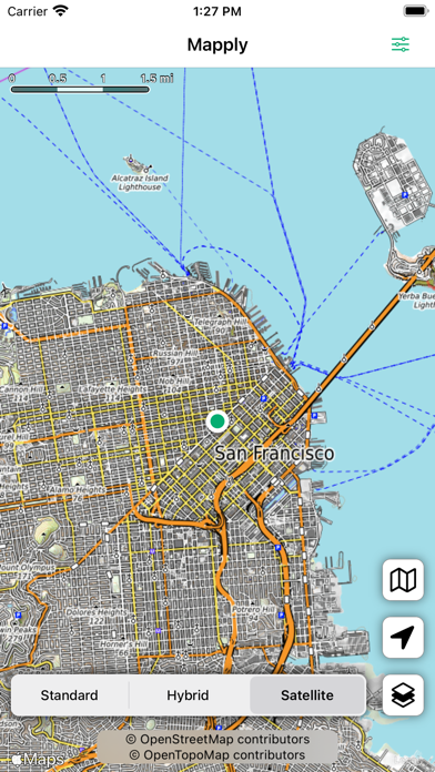
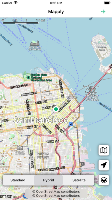
Transport Network with Open Transport Map: Dive into the intricate infrastructure of transportation, encompassing airports, railway lines, stations, bus routes, and stops. Mapply's integration with OpenTransportMap is your indispensable resource for navigating the intricacies of modern transportation.
Embark on Marine Journeys with Open Sea Map: OpenSeaMap opens the door to your nautical adventures, offering intricate details about harbors, buoys, and more. It's the perfect tool for sailors, explorers, and maritime enthusiasts to navigate with confidence.
Unleash Outdoor Adventures with Waymarked Trails: Mapply brings the outdoor world to your fingertips, providing specialized maps for a myriad of activities such as hiking, cycling, mountain biking, and skiing. From easy-going cycling routes to challenging mountain biking trails, and from serene hiking paths to exhilarating ski slopes - all your outdoor adventures begin with Mapply.
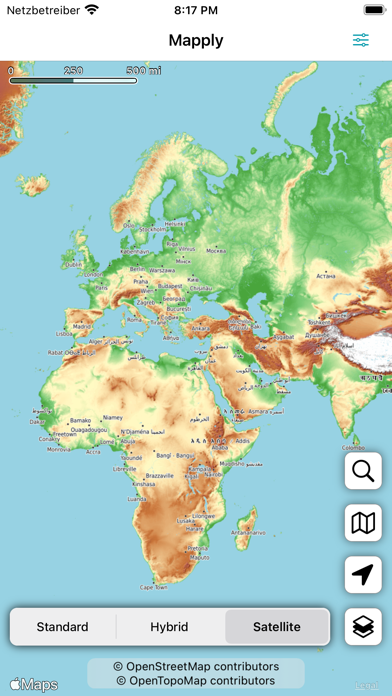
Discover Topography with Open Topo Map: Mapply leverages OpenTopoMap to provide users with precise topographical information. Understand the height profiles of specific areas, and plan your journeys with in-depth knowledge of the terrain.
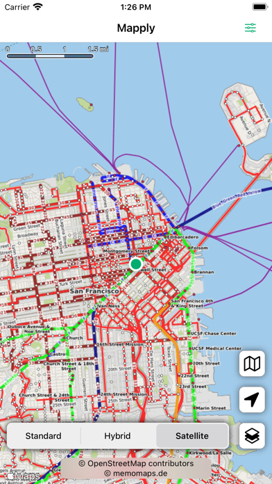
Unravel Railways with Open Railway Map: Mapply is a treasure trove for railway enthusiasts. OpenRailwayMap offers comprehensive data on global train tracks, and further layers reveal specifics about maximum speeds, signals, electrification, and track gauge. It's a comprehensive guide to the world's railways, all on your device.
Stamen Design: Stamen Design delivers maps that are as unique as your journeys. Choose from artistic watercolor-inspired maps, sleek black and white designs, or maps emphasizing terrain features - and see the world through a new lens.
Enhanced User Experience with Offline Caching: Mapply ensures your adventures are uninterrupted with its offline caching feature. Once you've explored an area, Mapply caches it on your device.
Mapply is built on open-source data for map data and overlay styles, displaying attributions in-app. We're always eager to enhance your Mapply experience and welcome suggestions for additional maps to be included in future updates. Start your journey with Mapply, and open up a world of exploration.
Maps included:
- OpenStreetMap: The collaborative project that offers a free, editable map of the world
- OpenTransportMap: Your go-to resource for transportation details
- OpenSeaMap: The ultimate marine cartography platform
- Waymarked Trails - Hiking: Comprehensive hiking trail maps
- Waymarked Trails - Cycling: Detailed cycling route maps
- Waymarked Trails - Mountain Biking: Expert mountain biking trail maps
- Waymarked Trails - Slopes: Extensive skiing slope maps
- OpenTopoMap: Your source for detailed topographic maps
- OpenRailwayMap - Standard: Comprehensive train track maps
- OpenRailwayMap - Max Speed: Speed limit details for train tracks
- OpenRailwayMap - Signals: Signal locations on train tracks
- OpenRailwayMap - Electrification: Electrification data for train tracks
- OpenRailwayMap - Track Gauge: Track gauge information for train tracks
- Stamen Design - Watercolor: Artistic, watercolor-inspired maps
- Stamen Design - Toner: Sleek, black and white maps
- Stamen Design - Terrain: Maps emphasizing terrain features