アプリオンは、世界のアプリランキングや口コミから、おすすめアプリをまとめている人気アプリ探しサイトです。

GeoFlyer Europe 3D Maps [iPhone]

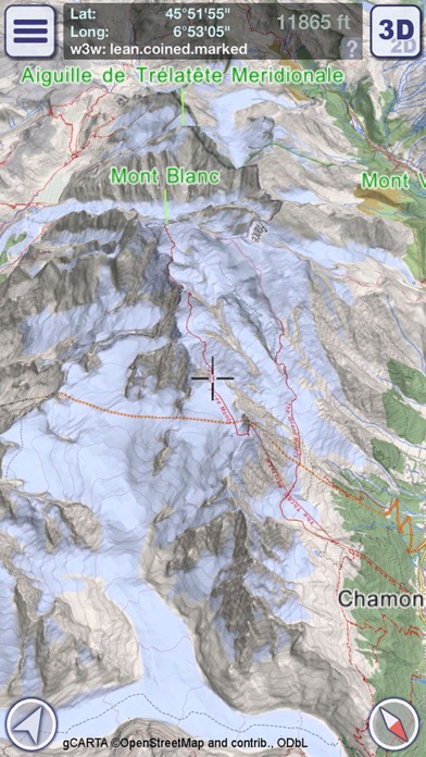
GeoMindが配信するiPhoneアプリ「GeoFlyer Europe 3D Maps」の評価や口コミやランキング推移情報です。このアプリには「ナビゲーション」「旅行」などのジャンルで分類しています。APPLIONでは「GeoFlyer Europe 3D Maps」の他にもあなたにおすすめのアプリのレビューやみんなの評価や世界ランキングなどから探すことができます。

現在、このアプリは非公開になっている可能性があります (探す)
  • ベスト新着 AppStoreベスト新着アプリに掲載
GeoFlyer Europe 3D Mapsのおすすめ画像1
GeoFlyer Europe 3D Mapsのおすすめ画像2
GeoFlyer Europe 3D Mapsのおすすめ画像3
GeoFlyer Europe 3D Mapsのおすすめ画像4
GeoFlyer Europe 3D Mapsのおすすめ画像5
<
>

GeoMindの地図/ナビアプリ

「GeoFlyer Europe 3D Maps」は、GeoMindが配信する地図/ナビアプリです。

ナビゲーション 旅行

このアプリの話題とニュース

  • 新バージョン1.5.0が配信開始。新機能や改善アップデートがされています。


  • 2014年8月15日(金)にiPhoneとiPad両対応のユニバーサルアプリとしてリリース!


最新更新情報

version1.5.0が、2018年1月20日(土)にリリース

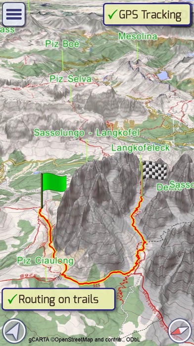
* Added Hiking Mode to the Routing tool
* Improved the iCloud synchronization of tracks
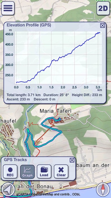
* Improved the height graph of GPS tracks

使い方や遊び方

How would you like a mapping app with routing and GPS tracking that offers you the BEST 3D VISUALIZATION for the outdoors?


How would you like a mapping app that shows points of interest in 3D with info or links to embedded Wikipedia pages?


How would you like a mapping app that works OFFLINE, too?


GeoFlyer 3D Maps offers you all this and more!


If you love hiking, biking, horseback riding, or any other outdoor activity, GeoFlyer 3D Maps is the app you need.


MAIN FEATURES
- Online and Offline modes (with preloading of selected areas)
- Highly-detailed 3D terrain
- 3D labels/icons of Points of Interest (POIs)
- Integrated Wikipedia descriptions
- Place searching by name (Online and Offline)
- GPS tracking
- Routing
- Personal Points of Interest (POIs)
- Sync of tracks and routes on all your devices (iCloud)
- Altimetry graph and statistics
- Custom-made gCARTA topographic chart
- Gyroscope features: GyroPilot and First Person View (Immersive Reality)


GeoFlyer 3D Maps Europe reproduces the terrain in 3D with stunning details, using the best available digital elevation models from NASA and various European mapping agencies.


The terrain is overlaid with a custom-made topographic chart (gCARTA) that shows trails and accurate elevation contour lines, or aerial images if you prefer.


Find out more about a POI using the labels and icons. Wikipedia geo-tagged entries and other associated content are integrated right into the 3D map.


Plan your trip using multiple routing options, and save your routes for later use.


Record your GPS tracks and share them with your friends through Facebook or other social media.


Get the best from your outdoor experience with the “First Person View” mode, a sort of augmented reality feature that enables you to see a virtual 3D view of what is in front of you, allowing you to identify peaks and other landmarks.


And it’s fun! Try the GyroPilot mode: dive into the valleys with a low level flyby, handling your device like a virtual plane, and explore the maps like a top-gun pilot!


GeoFlyer 3D Maps… your outdoor companion!


WARNING
Continued use of GPS running in the background can dramatically decrease battery life.

最新ストアランキングと月間ランキング推移

GeoFlyer Europe 3D MapsのiPhoneアプリランキングや、利用者のリアルな声や国内や海外のSNSやインターネットでの人気状況を分析しています。

基本情報

仕様・スペック

対応OS
8.0 以降
容量
58.6 M
推奨年齢
全年齢
アプリ内課金
なし
更新日
2018/01/20

リリース日
2014/08/15

集客動向・アクティブユーザー分析

オーガニック流入

アクティブ率

※この結果はGeoFlyer Europe 3D Mapsのユーザー解析データに基づいています。

ネット話題指数

開発会社の配信タイトル

このアプリと同一カテゴリのランキング

ヨックモック シガール
ヨックモック
amazon

GeoMind のアプリ

GeoMind の配信アプリ >

新着おすすめアプリ

新着おすすめアプリ >

注目まとめ

iPhoneアプリまとめ >