アプリオンは、世界のアプリランキングや口コミから、おすすめアプリをまとめている人気アプリ探しサイトです。

onX Backcountry: 3D Trail Maps [iPhone]

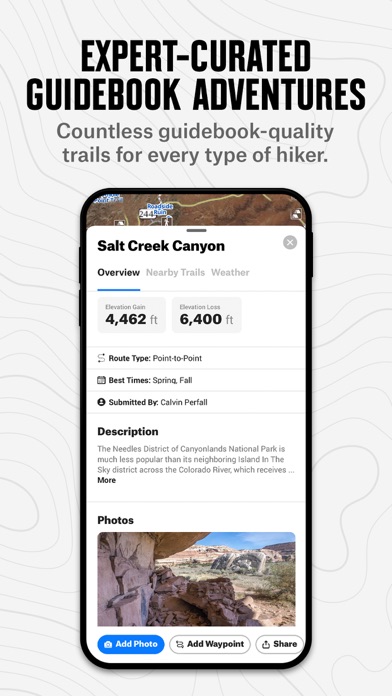
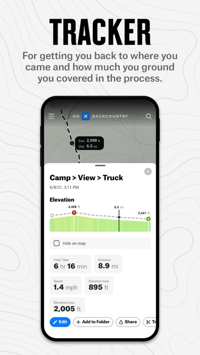
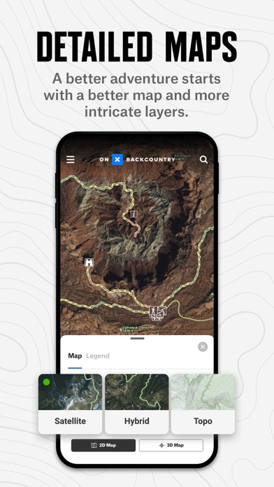
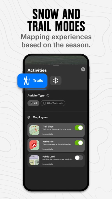
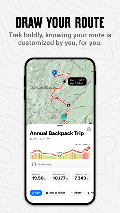
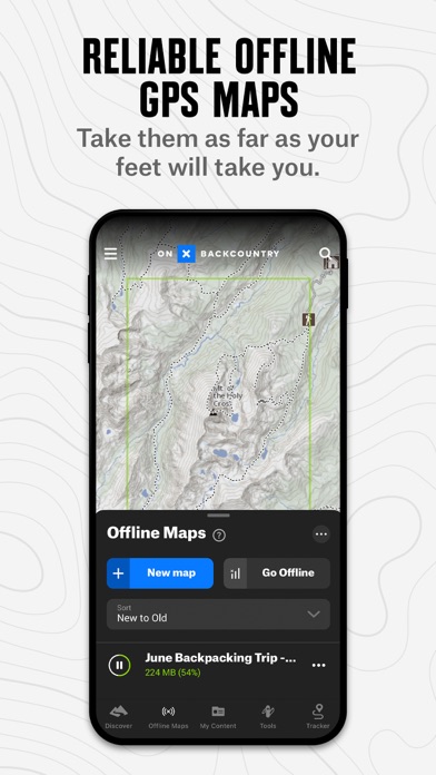
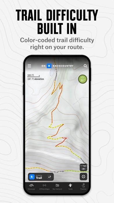
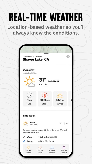
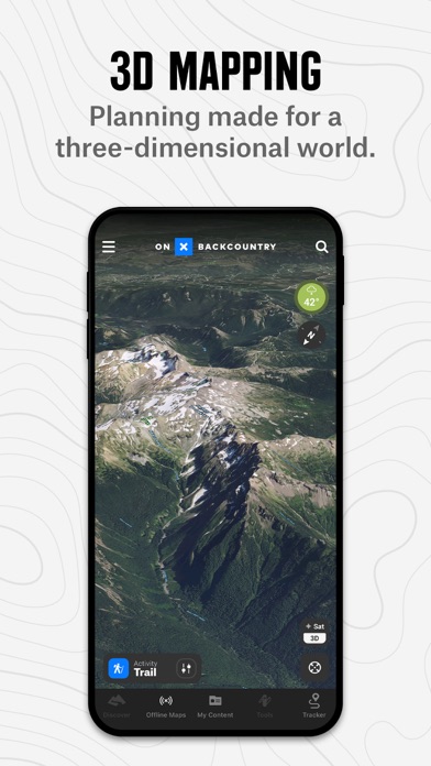
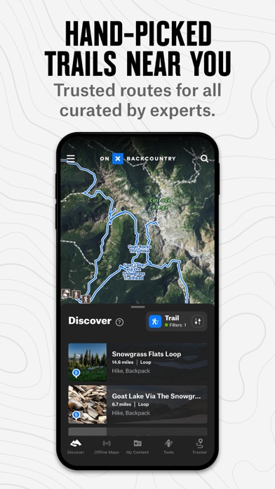
onXmaps, Inc.が配信するiPhoneアプリ「onX Backcountry: 3D Trail Maps」の評価や口コミやランキング推移情報です。このアプリには「ナビゲーション」「スポーツ」などのジャンルで分類しています。APPLIONでは「onX Backcountry: 3D Trail Maps」の他にもあなたにおすすめのアプリのレビューやみんなの評価や世界ランキングなどから探すことができます。

現在、このアプリは非公開になっている可能性があります (探す)
onX Backcountry: 3D Trail Mapsのおすすめ画像1
onX Backcountry: 3D Trail Mapsのおすすめ画像2
onX Backcountry: 3D Trail Mapsのおすすめ画像3
onX Backcountry: 3D Trail Mapsのおすすめ画像4
onX Backcountry: 3D Trail Mapsのおすすめ画像5
onX Backcountry: 3D Trail Mapsのおすすめ画像6
onX Backcountry: 3D Trail Mapsのおすすめ画像7
onX Backcountry: 3D Trail Mapsのおすすめ画像8
onX Backcountry: 3D Trail Mapsのおすすめ画像9
onX Backcountry: 3D Trail Mapsのおすすめ画像10
<
>

onXmaps, Inc.の地図/ナビアプリ

「onX Backcountry: 3D Trail Maps」は、onXmaps, Inc.が配信する地図/ナビアプリです。

ナビゲーション スポーツ

このアプリの話題とニュース

  • 新バージョン22.23.0が配信開始。新機能や改善アップデートがされています。


  • 2020年12月9日(水)にiPhoneとiPad両対応のユニバーサルアプリとしてリリース!


最新更新情報

version22.23.0が、2022年6月24日(金)にリリース

We improved user experience with a few bug fixes as well as preparing the app for future feature updates.

使い方や遊び方

Spring is here, and the onX Backcountry App is your ultimate guide to discovering new adventures, knowing exactly where you are in the backcountry (even without cell service), and getting home safely after a day -- or a week! -- in the mountains. Brought to you by onX, the leader in outdoor-recreation mapping apps loved by millions of users, onX Backcountry provides the unique combination of guidebook-quality trail content and photos, always-available GPS location data, and an easy-to-use contextual mapping experience including 3D, distance and tracking tools, your photos on the map, and more.


WHY USE A MAPPING APP?
onX Backcountry turns your phone into a robust GPS navigation system and trail finder with real-time location tracking. View backcountry trails near you with photos and descriptions, explore 24K topographic and satellite maps, unlock a whole new season of hiking and backpacking adventure, find public land, check the 7-day weather forecast -- and for backcountry skiing and splitboarding, study avalanche forecasts and slope angles. Your outdoor adventure is up to you, onX Backcountry goes as far as you do.


TAKE YOUR MAPS WITH YOU:
OFFLINE GPS NAVIGATION
Turn your phone into a powerful GPS navigation unit even when you’re off the grid. With onX Backcountry, save Offline Maps to be able to see your exact location on the map, even without cell service. Track your route while sliding on snow to always know where you are.


FIND INSPIRATION:
GUIDEBOOK FOR SKI TOURING & HIKING TRAILS
Discover your next trails adventure by choosing from our industry-leading 650,000 mile network of trails, or try one of our 10,000+ Featured Adventures to see detailed trail information including photos, description, difficulty, distance, elevation, etc. Also explore 450,000 outdoor recreation “points of interest” and more than 54,000 campsites. It’s a digital guidebook and outdoor trip planner in your pocket!


MAP YOUR MEMORIES:
MARK WAYPOINTS WITH YOUR PHOTOS
Add waypoints to the map to mark spots you loved, to remember where to explore next time, or to share with a friend. Make it a memory by adding photos. Customize your waypoints with icons for campsites, summits, lines, couloirs, cornice, skin tracks, water crossings, and more.


7-DAY FREE TRIAL
While many onX Backcountry features are free, some features require a paid membership. We offer a 7-day free trial with access to all the features. No credit card required -- you decide when or if you’d like to purchase. If you choose not to buy, you’ll continue to have access to the free version of onX Backcountry app, including basic trail maps, weather, and Waypoints.


ONX BACKCOUNTRY MEMBERSHIP
onX Backcountry is available on an introductory offer of 25% off through 2021 -- $29.99 for the initial year and renewing at $39.99/year. With a Membership, you’ll unlock these top features:
• Know where to go: Guidebook-quality trail & snow content, with photos and descriptions
• Know where you are with unlimited Offline Maps for hiking trails, backpacking, and everything in between.
• Explore maps in 3D, plus 24K topo and satellite maps
• Discover and save your favorite hiking trails
• Access 985M+ acres of public land, including US Forest Service, BLM, and State Land
• Track real-time speed, distance, elevation, and duration of your hike with Tracker


THE onX MISSION
Our mission is to awaken the adventurer inside everyone. onX products are built by adventurers, for adventurers. Our appreciation for wild places drives us to preserve access to the recreation that we cherish. As a company, we invest in land access initiatives to expand and protect open spaces. Read more about our land access initiatives here: https://www.onxmaps.com/onx-access-initiatives


FEEDBACK
Want to request new features? Contact us at support@onxmaps.com

最新ストアランキングと月間ランキング推移

onX Backcountry: 3D Trail MapsのiPhoneアプリランキングや、利用者のリアルな声や国内や海外のSNSやインターネットでの人気状況を分析しています。

基本情報

仕様・スペック

対応OS
14.0 以降
容量
293 M
推奨年齢
全年齢
アプリ内課金
あり
更新日
2022/06/24

リリース日
2020/12/09

集客動向・アクティブユーザー分析

オーガニック流入

アクティブ率

※この結果はonX Backcountry: 3D Trail Mapsのユーザー解析データに基づいています。

アプリ内課金の売れ筋ランキング

  • 1位: Backcountry Premium Yearly (3500円)

  • 2位: Backcountry Premium Yearly (3500円)

ネット話題指数

開発会社の配信タイトル

このアプリと同一カテゴリのランキング

ファイナルファンタジーVII リメイク ボードゲーム マテリアハンター
スクウェア・エニックス
amazon

onXmaps, Inc. のアプリ

onXmaps, Inc. の配信アプリ >

新着おすすめアプリ

新着おすすめアプリ >

注目まとめ

iPhoneアプリまとめ >