アプリオンは、世界のアプリランキングや口コミから、おすすめアプリをまとめている人気アプリ探しサイトです。
アプリオンは、世界のアプリランキングや口コミから、おすすめアプリをまとめている人気アプリ探しサイトです。
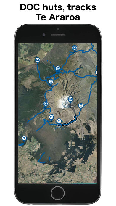
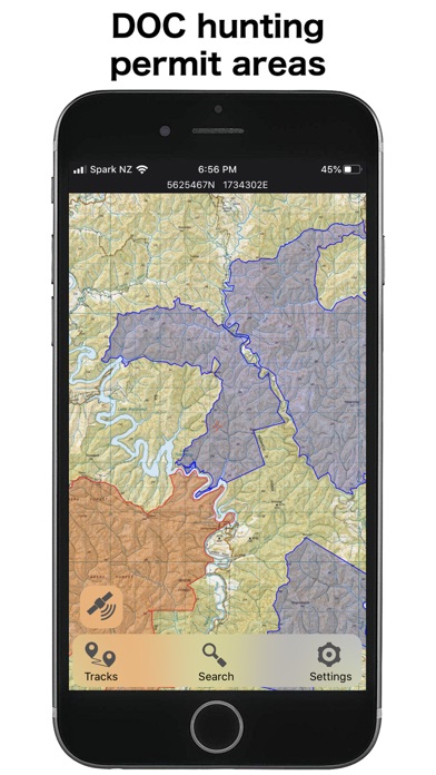
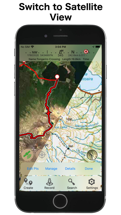
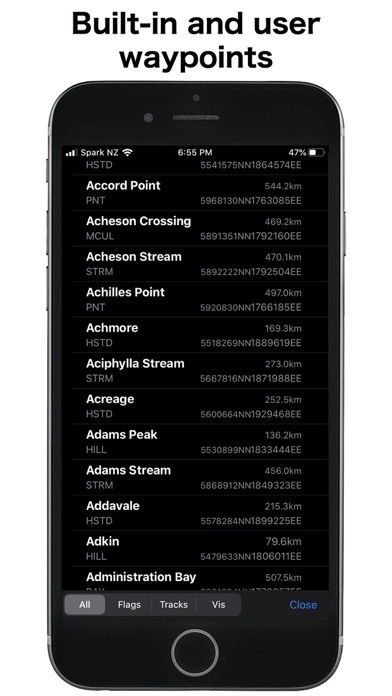
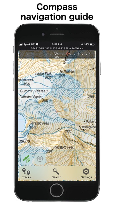
Right Place Resourcesが配信するiPhoneアプリ「NZ Topo50 North Island」の評価や口コミやランキング推移情報です。このアプリには「ナビゲーション」「スポーツ」などのジャンルで分類しています。APPLIONでは「NZ Topo50 North Island」の他にもあなたにおすすめのアプリのレビューやみんなの評価や世界ランキングなどから探すことができます。

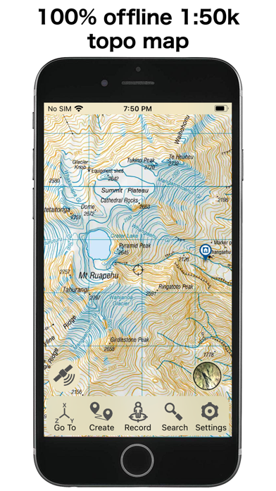
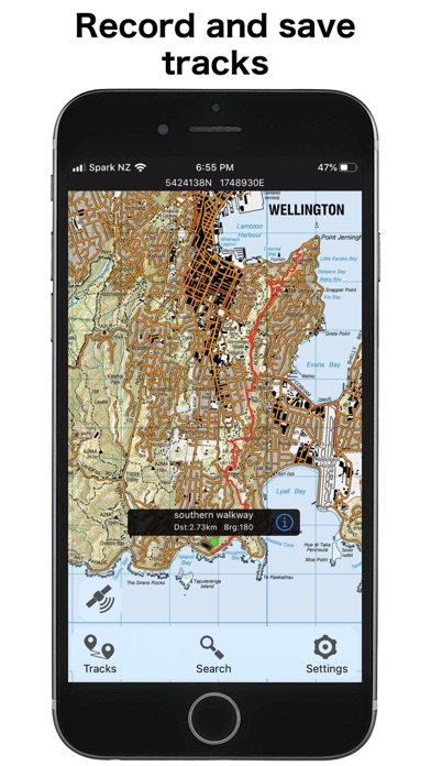
NZ Topo50 North Island
Right Place Resources
¥600
iPhone / iPad対応
|
80 Trend |

このアプリの話題とニュース
新バージョン5.80.05が配信開始。新機能や改善アップデートがされています。(1/30)
2013年2月21日(木)にiPhoneとiPad両対応のユニバーサルアプリとしてリリース!
最新更新情報
version5.80.05が、2024年1月30日(火)にリリース
Updated maps and data
Support for custom map images
New scrolling interface - more info where you need it
Duplicate tracks easily
Map alignment with course option
Dedicated fullscreen button
Other improvements
NZ Topo50 North IslandのiPhoneアプリランキングや、利用者のリアルな声や国内や海外のSNSやインターネットでの人気状況を分析しています。
|
|
※この結果はNZ Topo50 North Islandのユーザー解析データに基づいています。
1位: Product Support (900円)
2位: Product Support (100円)
![]()
あると思いますっ!
※デモグラフィックデータを元にユーザー層の性別や年齢分布などを考慮して推定しています。

¥700→¥600 : 太陽が昇らなくなった闇の世界で、老剣士・銃器女・仮面の男の3人の物語を描いた、ダークソウル系3D剣閃アクションRPG『Pascal's Wager(パスカルズ・ウェイジャー : パスカルの賭け)』が期間限定値下げ!
2024年04月30日 23:25

¥1,200→¥700 : 音楽アプリ『Analyser & Tuner AUv3 Plugin』が期間限定値下げ!
2024年04月29日 14:20

不思議な世界へ繋がる4冊の本の謎を解く、本格謎解き脱出アドベンチャーゲーム『魅惑的な世界』へのアクセス利用数が伸びる
2024年04月29日 13:00

石器時代から近未来まで、都市や文化を気付き文明を作り上げていく、ターン制文明発展シミュレーションゲーム『シヴィライゼーション6(Sid Meier's Civilization VI)』がネットで取り上げられ話題に
2024年04月28日 17:00

廃墟となったおもちゃ工場を舞台に、取り残された工具などを使ってアイテムを作り、恐怖から逃れる、サバイバルホラーゲーム『Poppy Playtime Chapter 1』が面白いと人気が出始めている模様
2024年04月30日 17:00