アプリオンは、世界のアプリランキングや口コミから、おすすめアプリをまとめている人気アプリ探しサイトです。

First Responder Support Tools [iPhone]

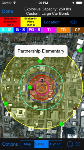
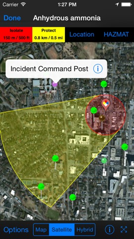
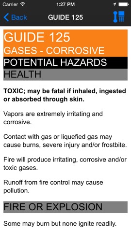
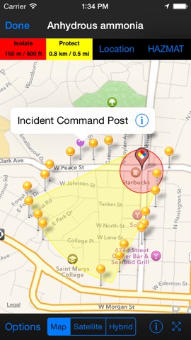
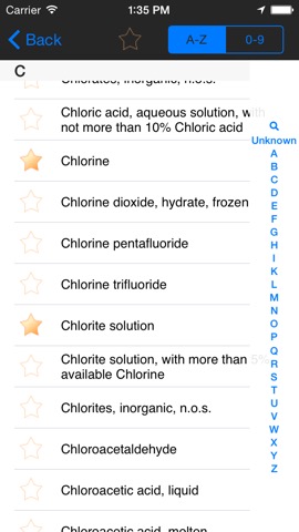
Applied Research Associatesが配信するiPhoneアプリ「First Responder Support Tools」の評価や口コミやランキング推移情報です。このアプリには「辞書/辞典/その他」「仕事効率化」などのジャンルで分類しています。APPLIONでは「First Responder Support Tools」の他にもあなたにおすすめのアプリのレビューやみんなの評価や世界ランキングなどから探すことができます。

現在、このアプリは非公開になっている可能性があります (探す)
  • ベスト新着 AppStoreベスト新着アプリに掲載
First Responder Support Toolsのおすすめ画像1
First Responder Support Toolsのおすすめ画像2
First Responder Support Toolsのおすすめ画像3
First Responder Support Toolsのおすすめ画像4
First Responder Support Toolsのおすすめ画像5
<
>

Applied Research Associatesの辞書/翻訳系アプリ

「First Responder Support Tools」は、Applied Research Associatesが配信する辞書/翻訳系アプリです。

辞書/辞典/その他 仕事効率化

このアプリの話題とニュース

  • 新バージョン4.3.1が配信開始。新機能や改善アップデートがされています。


  • 2011年11月22日(火)にiPhoneとiPad両対応のユニバーサルアプリとしてリリース!


最新更新情報

version4.3.1が、2017年12月6日(水)にリリース

This app has been updated by Apple to display the Apple Watch app icon.

Fixed a crash when attempting to email HazMat results.

使い方や遊び方

FiRST provides First Responders and Emergency Managers easy access to map-based improvised explosive device (IED) standoff distances and HAZMAT spill evacuation areas. The IED standoff data is based on criteria set by the DHS Office for Bombing Prevention and FEMA 426, Reference Manual to Mitigate Potential Terrorist Attacks Against Buildings. Hazmat evacuation and reference data is based on the 2016 Emergency Response Guidebook (ERG). Users are able to define custom IED types and standoff values.


Features of the software include:
•Display IED Mandatory Evacuation and Shelter-in-Place Zones for 8 pre-defined bomb sizes
•Display Isolation Zones and down-wind Protection Zones for over 3,000 chemicals
•Display distance to glass breakage, injury, and structural damage based on pre-defined bomb sizes (limited to users registering with a .gov, .mil, or .us email)
•Information displayed on phone maps, with similar functionality to zoom, search by address, current location, and map/satellite/hybrid views
•Automatically retrieve current weather from Weatherbug (www.weather.weatherbug.com) or forecast weather from the National Weather Service (US only) or Meteorologisk Institutt (Worldwide); weather can also be user input or input using the phone’s compass functionality
•Results shown geographically as well as text based
•Search and display predefined points of interest (schools, nurseries, hospitals, police/fire stations, and government facilities) from GIS search services to identify key facilities within the incident area
•Run roadblock analysis service that identifies within seconds the optimal location of roadblocks to isolate the incident area
•Place and label points on the map to identify key locations
•One-button summary of results (text, map image, map data shape and kml file attachments) in an email to disseminate to other responding personnel
•Includes reference material from the 2016 ERG and important chemical contacts for quick calling
•Store map images (including legends) for reference when connectivity prevents access to network maps


For more information, go to www.firstsupporttools.com

最新ストアランキングと月間ランキング推移

First Responder Support ToolsのiPhoneアプリランキングや、利用者のリアルな声や国内や海外のSNSやインターネットでの人気状況を分析しています。

基本情報

仕様・スペック

対応OS
7.1 以降
容量
22.4 M
推奨年齢
12歳以上
アプリ内課金
なし
更新日
2017/12/06

リリース日
2011/11/22

集客動向・アクティブユーザー分析

オーガニック流入

アクティブ率

※この結果はFirst Responder Support Toolsのユーザー解析データに基づいています。

ネット話題指数

開発会社の配信タイトル

このアプリと同一カテゴリのランキング

THE FIRST SLAM DUNK Blu-rayスタンダード・エディション
井上雄彦
amazon

Applied Research Associates のアプリ

Applied Research Associates の配信アプリ >

新着おすすめアプリ

新着おすすめアプリ >

注目まとめ

iPhoneアプリまとめ >