アプリオンは、世界のアプリランキングや口コミから、おすすめアプリをまとめている人気アプリ探しサイトです。

mKart Marine Navigation [iPhone]

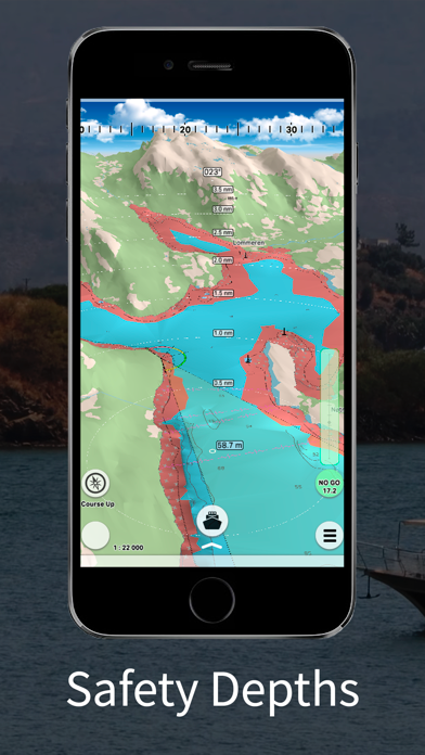
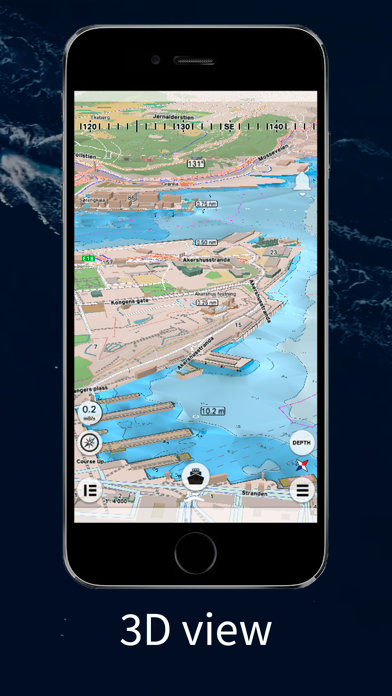
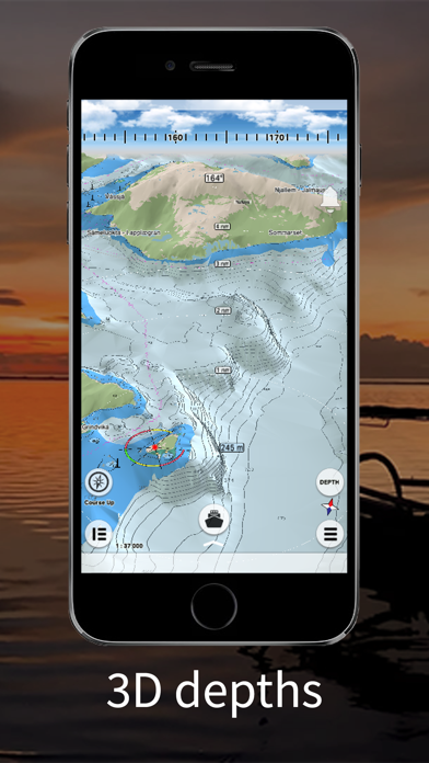
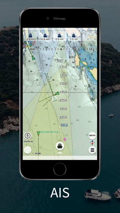
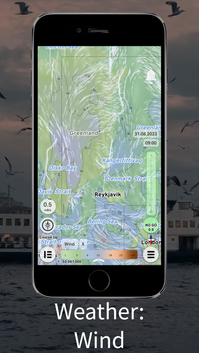
GEOPHONE GROUP INTERNATIONAL Oyが配信するiPhoneアプリ「mKart Marine Navigation」の評価や口コミやランキング推移情報です。このアプリには「ナビゲーション」「旅行」などのジャンルで分類しています。APPLIONでは「mKart Marine Navigation」の他にもあなたにおすすめのアプリのレビューやみんなの評価や世界ランキングなどから探すことができます。

mKart Marine Navigationのおすすめ画像1
mKart Marine Navigationのおすすめ画像2
mKart Marine Navigationのおすすめ画像3
mKart Marine Navigationのおすすめ画像4
mKart Marine Navigationのおすすめ画像5
mKart Marine Navigationのおすすめ画像6
<
>

GEOPHONE GROUP INTERNATIONAL Oyの地図/ナビアプリ

「mKart Marine Navigation」は、GEOPHONE GROUP INTERNATIONAL Oyが配信する地図/ナビアプリです。

ナビゲーション 旅行

このアプリの話題とニュース

  • 新バージョン1.8.727が配信開始。新機能や改善アップデートがされています。(9/10)


  • 2020年1月28日(火)にiPhoneとiPad両対応のユニバーサルアプリとしてリリース!


最新更新情報

version1.8.727が、2023年9月10日(日)にリリース

We have added the ability to purchase an ENC via the GetENC service to the app.
Now buying a PRIMAR charts has become even faster and easier.

使い方や遊び方

mKart 3D marine App is for safe and comfortable navigation.


Product Highlights:


WEB CONSOLE:
E-shop;
ENCs and cartographic products Catalogue;
Portfolio optimization;
Fleet management;
Roots and tracks;
Data exchange;
Accounting;

SAFETY IS IN FOCUS:
Automatic routing and NO-GO Area display;
Dangerous depths and objects automatic control.
Safe sailing alternative and recommendations;
Meeting points and hazardous traverses calculations.
Background monitoring: dangers’ and ships’ alerts, all along the route.
Apple watch support.

DOCKING:
Click on the chart, select the location and follow the docking path.


3D MARINE AND OSM CHARTS:
3D marine and OSM charts are uploaded and displayed automatically. 3D sea floor, land’s relief, 3D buildings, ships and infrastructure models contribute to better seafarers orientation and awareness.

FREE NOAA ENCs:
Online NOAA nautical charts are being installed automatically via Internet by customer’s position or while browsing and stored for off-line use. Updating is performed in the same way.


PRIMAR ENCs:
You can buy PRIMAR electronic charts for the whole world directly in the app.


SMART PANELS:
Swipe from below and from side to side. Profiles of seabed relief, safety path simulator, docking.


MARINE ROUTE PLANNER:
Save time with integrated sea and river auto routes functionality. Safety checks is implemented along with route monitoring functionality and warning system.


NO GO ZONE:
Display safety area is filled up graphically on the sea map by only safe depth. Safety zone is calculated trough 3D sea bottom model.


MARINE TRAFFIC:
Marine traffic data can be obtained from open AIS streams over Internet to display and identify dangerous targets.


COMPASS MODE:
Get a quick look around while boat navigation with advanced VR option for better orientation and using visual aids for navigation effectively.


SEARCH:
Search all objects and information on ENC S-57 charts trough SW and data via universal search function.


MARINE WEATHER:
mKart online services allows to deliver highly detailed weather information and forecast.


TRACKS AND WAYPOINTS:
PLT and GPX import and export, recording and displaying on the chart.

最新ストアランキングと月間ランキング推移

mKart Marine NavigationのiPhoneアプリランキングや、利用者のリアルな声や国内や海外のSNSやインターネットでの人気状況を分析しています。

基本情報

仕様・スペック

対応OS
8.0 以降
容量
89.8 M
推奨年齢
全年齢
アプリ内課金
あり
更新日
2023/09/10

リリース日
2020/01/28

集客動向・アクティブユーザー分析

オーガニック流入


アクティブ率


※この結果はmKart Marine Navigationのユーザー解析データに基づいています。

アプリ内課金の売れ筋ランキング

  • 1位: NMA (1850円)

  • 2位: Estonian Marine Charts (960円)

利用者の属性・世代

アプリ解析デモグラフィックデータ(男女年代比率52%)

ちょっ待てよ

デモグラフィックデータを元にユーザー層の性別や年齢分布などを考慮して推定しています。

ネット話題指数

開発会社の配信タイトル

このアプリと同一カテゴリのランキング

ペルソナ3 リロード (PS5)
アトラス
amazon

GEOPHONE GROUP INTERNATIONAL Oy のアプリ

GEOPHONE GROUP INTERNATIONAL Oy の配信アプリ >

新着おすすめアプリ

新着おすすめアプリ >

注目まとめ

iPhoneアプリまとめ >