アプリオンは、世界のアプリランキングや口コミから、おすすめアプリをまとめている人気アプリ探しサイトです。

Israel Hiking Map [iPhone]

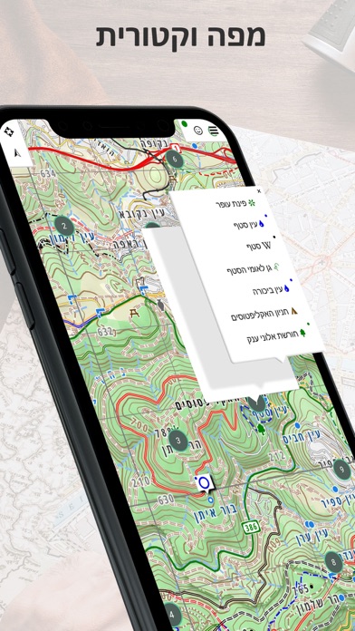
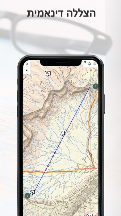
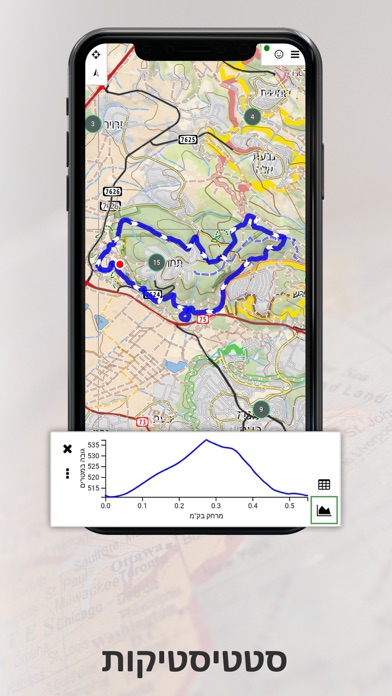
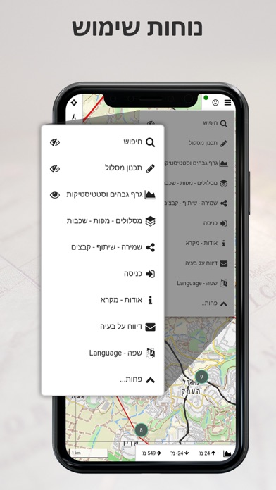
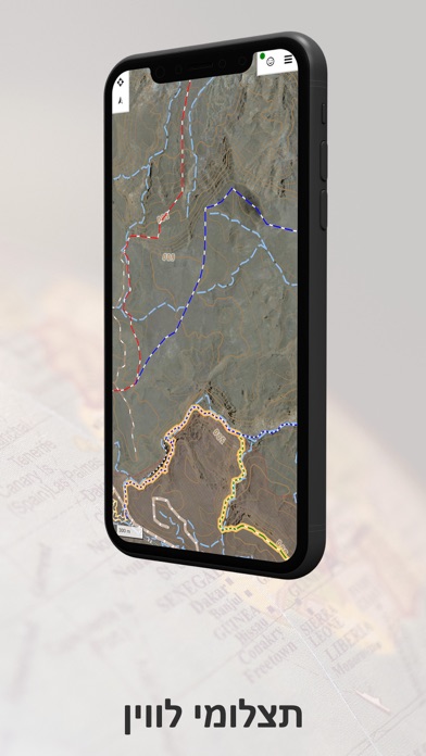
Mazor Harelが配信するiPhoneアプリ「Israel Hiking Map」の評価や口コミやランキング推移情報です。このアプリには「ナビゲーション」「旅行」などのジャンルで分類しています。APPLIONでは「Israel Hiking Map」の他にもあなたにおすすめのアプリのレビューやみんなの評価や世界ランキングなどから探すことができます。

Israel Hiking Mapのおすすめ画像1
Israel Hiking Mapのおすすめ画像2
Israel Hiking Mapのおすすめ画像3
Israel Hiking Mapのおすすめ画像4
Israel Hiking Mapのおすすめ画像5
Israel Hiking Mapのおすすめ画像6
Israel Hiking Mapのおすすめ画像7
Israel Hiking Mapのおすすめ画像8
<
>

Mazor Harelの地図/ナビアプリ

「Israel Hiking Map」は、Mazor Harelが配信する地図/ナビアプリです。

ナビゲーション 旅行

このアプリの話題とニュース

  • 新バージョンv9.15.55が配信開始。新機能や改善アップデートがされています。


  • 2019年12月16日(月)にiPhoneとiPad両対応のユニバーサルアプリとしてリリース!


最新更新情報

versionv9.15.55が、2022年12月2日(金)にリリース

The major changes in this version are:
- Fix an issue when changing point to point search
- Fix links not recognized by the app
- Added local walking trains from OSM and improved mountain bike route merge
- Added zoom buttons for wide screens
- Various bug fixes

See hhttps://github.com/IsraelHikingMap/Site/milestone/57?closed=1 for the full list.

使い方や遊び方

Israel Hiking Map is a powerful, yet simple to use, navigation and route-planning tool for the outdoors.
Geared towards hikers, bikers and off-road drivers it keeps you oriented in the Israeli backcountry even with no cellular reception.Use crisp topographic maps to navigate, familiarize with nearby points of interest, plan, import and share routes, synchronize effortlessly with our trip-planning site and much more.


Here’s what you get for free:
Maps
- Vector maps with unlimited zoom with no loss of quality
- A hiking map, complete with blazed trails
- A biking map, compete with single tracks marked for difficulty and marked bike routes
- Hebrew and English versions of all maps
- Text labels that orient to the viewers’ perspective
- A satellite image
- Transparent map overlays to show topography and trails over the satellite image
Depth perception
- High resolution contour lines based on spatial data from NASA
- Dynamic hill-shading which changes as the map rotates for accurate depth perception at a glance
- 3D models of many buildings in urban areas


Navigation
- Show your position and direction
- Orient the map north or in your direction of movement
- Record your path as you travel
- Analyze your speed and distance traveled


Routes
- Search for nearby routes for walking, driving and biking
- Plan your own routes – they would automatically follow the roads and paths on the map
- Manipulate routes – reverse, split or merge them at will
- Handle several routes at once
- Effortlessly synchronize with the routes you plan on our website
- Share routes or save them on your phone
- Analyze the height profile of routes


Points of Interest
- An extensive list of historical sites, tourist attractions, campsites, springs and viewpoints to visit
- Easy access to geo-located articles from Wikipedia and iNature
- Easily add your own POIs to the map


Offline Map Purchase:
You can buy a yearly subscription to our offline maps. Use them when you are out of reception or want to save your battery. The maps are continuously updated.


For EULA see: https://www.apple.com/legal/internet-services/itunes/dev/stdeula/

最新ストアランキングと月間ランキング推移

Israel Hiking MapのiPhoneアプリランキングや、利用者のリアルな声や国内や海外のSNSやインターネットでの人気状況を分析しています。

基本情報

仕様・スペック

対応OS
13.0 以降
容量
31.3 M
推奨年齢
全年齢
アプリ内課金
あり
更新日
2022/12/02

リリース日
2019/12/16

集客動向・アクティブユーザー分析

オーガニック流入


アクティブ率


※この結果はIsrael Hiking Mapのユーザー解析データに基づいています。

アプリ内課金の売れ筋ランキング

  • 1位: צפיה במפות ללא רשת - מנוי לשנה (3100円)

利用者の属性・世代

アプリ解析デモグラフィックデータ(男女年代比率52%)

気合だっ!気合だっ!気合だーーー!!!

デモグラフィックデータを元にユーザー層の性別や年齢分布などを考慮して推定しています。

ネット話題指数

開発会社の配信タイトル

このアプリと同一カテゴリのランキング

新型 PlayStation 5 デジタル・エディション(CFI-2000B01)
任天堂
amazon

新着おすすめアプリ

新着おすすめアプリ >

注目まとめ

iPhoneアプリまとめ >

ダウンロード数が多いおすすめアプリ

無料ゲームアプリランキング >