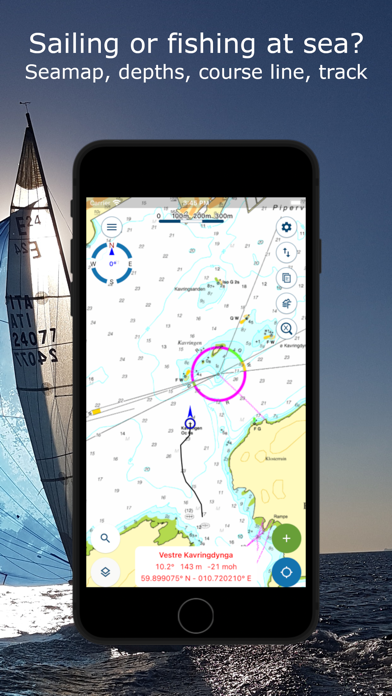
Norgeskart Outdoors has everything you need for your outdoor activities. Be it hunting and fishing, hiking, cycling, skiing or boating. All functions and content can be made available even without mobile coverage.
- Register, measure and categorise -
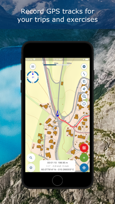
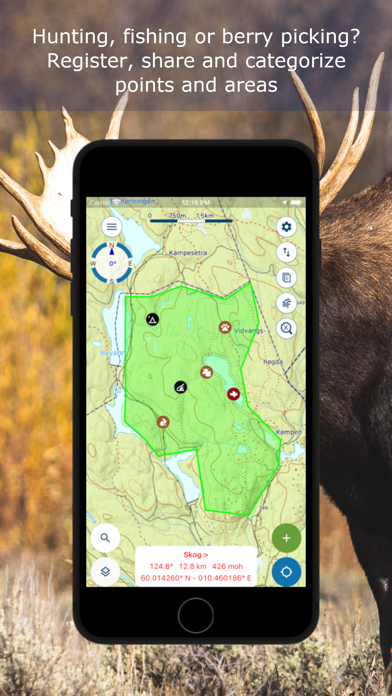
Register points of interest, routes, areas and record tracks. Organise the data by creating your own categories with colors and styles/icons for each category. If desired, your data can be written and read to/from GPX files or synchronised across devices and the map portal norgeskart.avinet.no. You can also easily share files with others from the lists of data in the app.
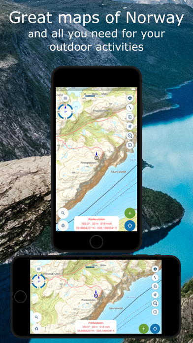
- Great outdoor maps and map layers -
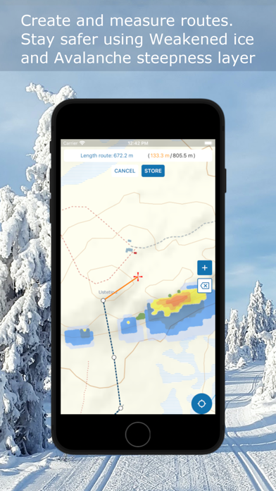
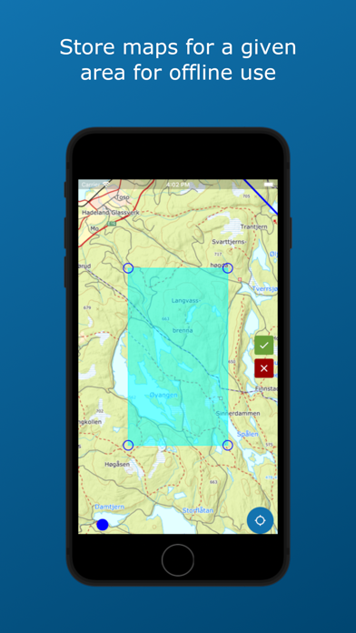
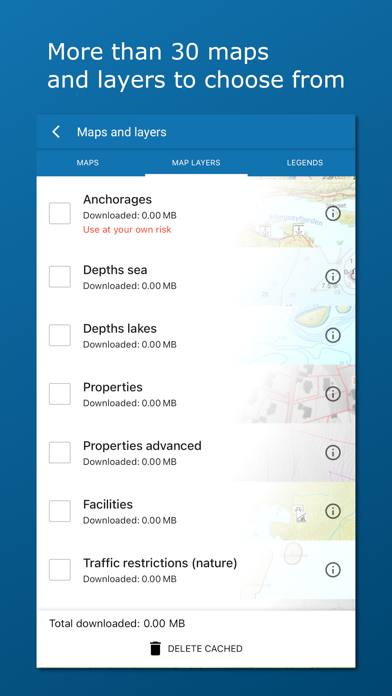
Choose from more than 40 maps and map layers. Beautiful topographical maps from the Norwegian mapping authorities can be downloaded before you go on a trip for offline use. Many apps only let you turn on one layer at a time, here you can combine as many layers as you wish to create a complete overview of your surroundings. E.g. by turning on Pistes, Avalanche steepness and Weak ice layers.
- Own map and map layers -
Are you missing a map or map layer? The app now supports adding your own maps and layers from WMS, WMTS, XYZ and TMS services. A great source for additional maps and layers in Norway is the site geonorge.no. You can also try adding maps from other countries, but the app only support Mercator and UTM33 projections.
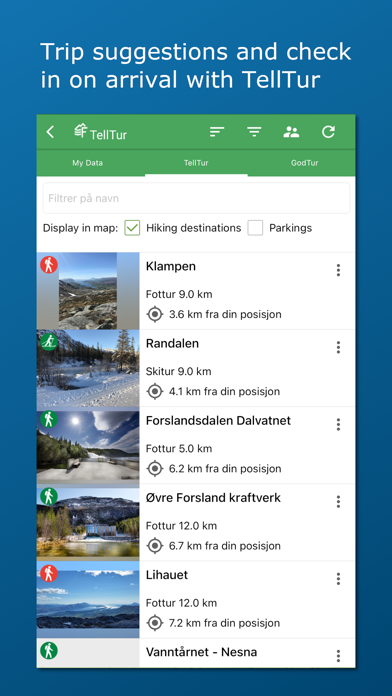
- TellTur -
Plan your next trip with trip suggestions and descriptions from telltur.no. With TellTur you can use the app to register when you arrive at a tour destination and compete with others to visit the most places.
This app contains both free and paid content (see complete overview below). By paying for a subscription, you support my development of the app and take full advantage of all the exciting things it has to offer.
Free content:
------------------
- Topo and nautical maps for Norway, Svalbard and Jan Mayen
- View place name and heigh/depth for cursor position
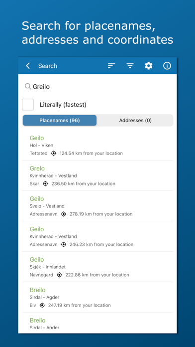
- Search for place names, addresses or coordinates
- Import and export of GPX files
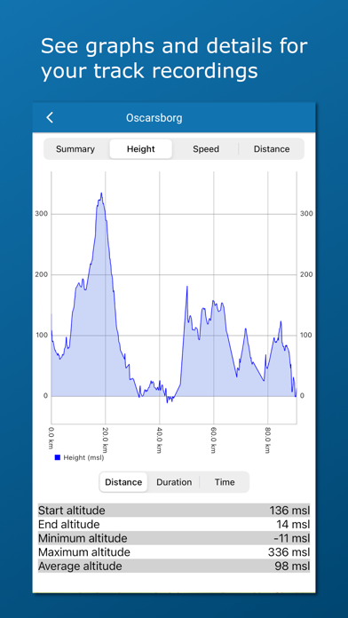
- Track recording with diagrams and details
- Create routes and POIs
- Compass
- Property borders
Pro subscription (99 NOK a year):
------------------
- (New) Create and measure areas
- (New) Create own categories .
- Download Norwegian maps for offline use
- Topo map for Sweden (offline, but without download area function)
- Upload POIs, tracks and routes
- Synchronize your data across devices and with map portal
- Economic (N5 raster) map
- Historical map
- Mountain bike routes
- Pistes for Alpine and Cross-country
- Avalanche awareness, steepness and incidents
- Weak ice
- Snow depth and skiing conditions
- Snowmobile tracks
- Sea depths and lake depths
- Outports. Not nationwide.
- Conservation areas
- Clay and radon
- Open air routes summer and winter
- Activities (bath spots, campfires etc). Not nationwide.
- Facilities (toilets, parkings etc). Not nationwide.
Pro+ subscription (199 NOK a year):
------------------
- All in Pro
- (New) Add your own maps and layers
- Periodic update of points from online KML files. Tested with TeleSpor.
The following applies to the auto-renewable subscriptions:
- Payment will be charged to iTunes Account at confirmation of purchase
- Subscription automatically renews unless auto-renew is turned off at least 24-hours before the end of the current period
- Account will be charged for renewal within 24-hours prior to the end of the current period, and identify the cost of the renewal
- Subscriptions may be managed by the user and auto-renewal may be turned off by going to the user's Account Settings after purchase
- Any unused portion of a free trial period, if offered, will be forfeited when the user purchases a subscription to that publication, where applicable
Terms of use: https://ture.no/en/terms-of-use-norgeskart-outdoors/
Privacy policy: https://ture.no/en/privacy-policy-norgeskart-outdoors/