アプリオンは、世界のアプリランキングや口コミから、おすすめアプリをまとめている人気アプリ探しサイトです。
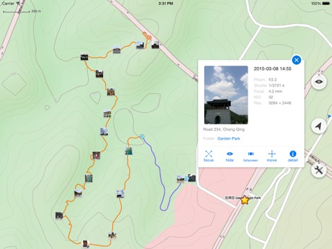
Map Plus [iPad]

Map Plus

無料  iPhone / iPad対応 ナビゲーション 仕事効率化 64bit 4.4 売上順位:ナビゲーション 143位 (iPad)

82
Trend
  • 入賞・受賞歴 月間ナビゲーション部門最高ランキング 118位を獲得!(4/3)
Map Plusのおすすめ画像1
Map Plusのおすすめ画像2
Map Plusのおすすめ画像3
Map Plusのおすすめ画像4
Map Plusのおすすめ画像5
<
>

Miocool Inc.の地図/ナビアプリ

「Map Plus」は、Miocool Inc.が配信する地図/ナビアプリです。

ナビゲーション 仕事効率化

このアプリの話題とニュース

  • 新バージョン2.9.0が配信開始。新機能や改善アップデートがされています。(4/16)


  • 2011年5月27日(金)にiPhoneとiPad両対応のユニバーサルアプリとしてリリース!


このレビュアーのおすすめコメント

使い方が分からず全く使っていませんでしたが^^;
オフラインマップへの対応や地図上にアイコンや図形、写真を配置出来て便利です
慣れてくると良い - ★★★★☆
Google earthの自動更新機能が無くなり困っていましたが、これで全て解決しました。位置精度もよく今では無くてはなりません。
なくてはならない - ★★★★★
Full featured and very powerful app.
Powerful - ★★★★★

最新更新情報

version2.9.0が、2024年4月16日(火)にリリース

- Layers support dynamically changing their "Selectable" options by conditional styles from the feature class.
- New setting option of "Edit Track After Saved".
- Supports more sorting methods in data and search result listing.
- Adds new JavaScript functions of "Title()", "Subtitle()" and "Q(selector, value)".
- Support editing titles and subtitles from HTML notes with a new URL scheme.
- Supports "Simple Info Panel" option for on-map popup info panel to be displayed neatly without title and subtitle.
- Other bug fixes.

使い方や遊び方

The most powerful and versatile tool for viewing and editing custom maps, surveying, editing or managing mass of your geography data.


● You can use Map Plus as a professional GIS tool for geographic data gathering, editing, measuring, cartography, surveying, planning, online/offline viewing and many other management.
● You can also use Map Plus to help your outdoor activities and global travels, for trip planning, offline map downloading, track/photo/video recording, and sharing memories with friends.


Besides common map features such as locating, searching, Map Plus provides many more special:


● Configuring, viewing and downloading any online maps of XYZ/WMS/WMTS patterns, or using scripts to configure more complex ones.
● Handling GIS vector file formats, such as Shape(SHP), TAB, GEOJSON, GML/GZ, AutoCAD DXF...
● Handling Common GIS file formats such as KML, KMZ, GPX, CSV, WPT.. Supported styles in KML/KMZ.
● Handling offline map file formats such as MBTiles, RMaps...
● On-map vector editing with finger drag-drop and magnetic snap.
● GPS Track Recording with auto-recovery and background mode support.
● Path Following with voice guidance for both user paths and searched direction routes.
● Displaying locations of photos and videos in your system photo albums. (no need to import)
● User data management with folders, sub-folders, layers, bulk operations, shortcuts, tags and fuzzy searches. Supports Advanced Search by using expressions with attribute conditions.
● Using Feature Class for bulk editing and managing similar (same class of) features and layers all together. Supports bulk Attributes Merge and Link Relationship Building between features of different classes.
● Conditional Style and Expression provide dynamic content rendering.
● Customizable pop-up panel for on-map picking items with HTML, JS and CSS support to make custom forms, layout and rich-formatted content.
● Handling coordinates in MGRS, UTM, and Plus Code.
● Photo Markup allows you draw markups on photo, such as arrows, texts, free-hand drawings.
● Browser Access allows you to access app's data or files from a desktop PC/Mac with a web browser wirelessly.
● Sharing or transferring data via Wi-Fi, Bluetooth, iCloud, SMS, Email, QR codes, Open-In, AirDrop or many other ways.
● Many more fantastic and free functions could not be fully descriped here, such as Guide Mark, Arrival Notification, Photo Mode, Map Level Adjust, Custom Icons, Photo/Video Attachments, Image Overlay, Text Overlay, Fast Editing, Distance/Perimeter/Area Measuring, Custom Time Zone, etc.


User Manual:
https://duweis.com/en/mapplus_guide.html


User Forum:
https://duweis.com/forums/viewforum.php?f=13


Contact Us:
support@duweis.com

カスタマーレビュー・評価

4.4
5つ星
 
19
4つ星
 
5
3つ星
 
3
2つ星
 
1
1つ星
 
1

最新ストアランキングと月間ランキング推移

Map PlusのiPadアプリランキングや、利用者のリアルな声や国内や海外のSNSやインターネットでの人気状況を分析しています。

基本情報

仕様・スペック

対応OS
12.0 以降
容量
40.9 M
推奨年齢
全年齢
アプリ内課金
あり
更新日
2024/04/16

リリース日
2011/05/27

集客動向・アクティブユーザー分析

オーガニック流入


アクティブ率


※この結果はMap Plusのユーザー解析データに基づいています。

アプリ内課金の売れ筋ランキング

  • 1位: Full-Function Package (3000円)

  • 2位: Remove Advertisements (600円)

  • 3位: Enhanced Format (400円)

  • 4位: Enhanced Map (100円)

  • 5位: Enhanced GIS (700円)

  • 6位: Large File Support (100円)

  • 7位: Enhanced Editing (900円)

  • 8位: Donate (300円)

  • 9位: Enhanced Photo (1300円)

  • 10位: Export GPX Support (400円)

利用者の属性・世代

アプリ解析デモグラフィックデータ(男女年代比率52%)

ゲッツ!!

デモグラフィックデータを元にユーザー層の性別や年齢分布などを考慮して推定しています。

ネット話題指数

開発会社の配信タイトル

このアプリと同一カテゴリのランキング

PlayStation 5 DualSense ワイヤレスコントローラー ダブルパック
ソニー・インタラクティブエンタテインメント
amazon

新着おすすめアプリ

新着おすすめアプリ >

注目まとめ

iPadアプリまとめ >

ダウンロード数が多いおすすめアプリ

無料ゲームアプリランキング >