アプリオンは、世界のアプリランキングや口コミから、おすすめアプリをまとめている人気アプリ探しサイトです。
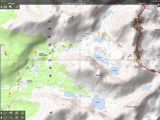
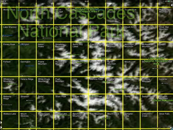
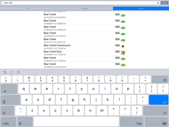
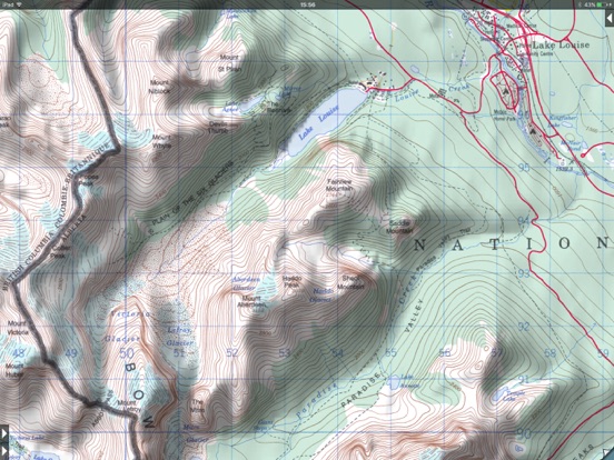
Topo Maps for iPad [iPad]

  • 入賞・受賞歴 月間ナビゲーション部門最高ランキング 121位を獲得!(4/17)
Topo Maps for iPadのおすすめ画像1
Topo Maps for iPadのおすすめ画像2
Topo Maps for iPadのおすすめ画像3
Topo Maps for iPadのおすすめ画像4
Topo Maps for iPadのおすすめ画像5
<
>

Mappendix Limitedの地図/ナビアプリ

「Topo Maps for iPad」は、Mappendix Limitedが配信する地図/ナビアプリです。

ナビゲーション 旅行

このアプリの話題とニュース

  • 新バージョン1.19が配信開始。新機能や改善アップデートがされています。


  • 2010年4月24日(土)にiPad版がリリース!


最新更新情報

version1.19が、2023年4月18日(火)にリリース

This is a minor update to fix bugs.

使い方や遊び方

* The iPad is a fantastic map viewer, and Topo Maps for iPad gives it access to over 70,000 USGS and Canadian topographical maps. * Ideal for hiking and other backcountry activities. * Map downloads are FREE! * More than 4 million maps downloaded so far! * Users write:


" I've bought all the topo map apps and I like this the best "


" Scans are gorgeous ... the interface is exceptionally clean "


" Downloading maps is easy and fast ... Map displays beautifully and zooms flawlessly "


* Includes Alaska (at 1:24,000 and 1:63,360) and Canada (at 1:50,000), plus Hawaii, Puerto Rico and the U.S. Virgin Islands.


* Locate the maps you need on the satellite view. To install a map, touch for about half a second. Touch again to view it.


* Search by name for over a million towns, peaks, lakes, parks and other features.


* No network connection is needed once the maps have been installed.


* Mark waypoints, and import and export waypoint files in GPX, KML and CSV formats.


* Touch the "current location" button to see where you are, and the compass button to align the map with the ground.


* See coordinates in NAD27 or WGS84 degrees, degrees minutes and seconds, UTM, or MGRS formats.


* Measure distances (miles, feet and km) and bearings (true and magnetic).


Coverage: this app makes available more than 70,000 maps covering the United States, including Alaska, Hawaii, Puerto Rico and the U.S. Virgin Islands, and Canada.


The Maps: This app uses high-quality scans of the traditional USGS and NRCan topographic maps which have been the definitive resource for hikers and other backcountry users for many years. You can make the terrain stand out with hill shading, using simulated sunlight from the direction of your choice. This app does not use the new "US Topo" maps because they do not show hiking trails and lack other details: please see the web site for more details.


Downloading: US maps are around 8 MB in size and download in a few seconds on a typical home broadband connection. Canadian maps are larger. Both cellular data and WiFi can be used, though WiFi is likely to be more reliable in most cases.


- Do please visit http://topomapsapp.com/ for complete instructions, so that you don't miss any features.


We have many ideas for additional features to add to future versions of this app; if you have ideas or other questions or comments, contact details can be found on the website, http://topomapsapp.com/. The website also has more screenshots and other information.

カスタマーレビュー・評価

1.0
5つ星
 
0
4つ星
 
0
3つ星
 
0
2つ星
 
0
1つ星
 
2

最新ストアランキングと月間ランキング推移

Topo Maps for iPadのiPadアプリランキングや、利用者のリアルな声や国内や海外のSNSやインターネットでの人気状況を分析しています。

基本情報

仕様・スペック

対応OS
13.0 以降
容量
118 M
推奨年齢
18歳以上
アプリ内課金
なし
更新日
2023/04/18

リリース日
2010/04/24

集客動向・アクティブユーザー分析

オーガニック流入


アクティブ率


※この結果はTopo Maps for iPadのユーザー解析データに基づいています。

利用者の属性・世代

アプリ解析デモグラフィックデータ(男女年代比率52%)

やばいよ、やばいよ~~

デモグラフィックデータを元にユーザー層の性別や年齢分布などを考慮して推定しています。
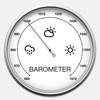
ネット話題指数

開発会社の配信タイトル

このアプリと同一カテゴリのランキング

ファイナルファンタジーVII リバース
スクウェア・エニックス
amazon

Mappendix Limited のアプリ

Mappendix Limited の配信アプリ >

新着おすすめアプリ

新着おすすめアプリ >

注目まとめ

iPadアプリまとめ >