アプリオンは、世界のアプリランキングや口コミから、おすすめアプリをまとめている人気アプリ探しサイトです。

Hazards and Population Mapper [iPad]

Hazards and Population Mapperのおすすめ画像1
Hazards and Population Mapperのおすすめ画像2
Hazards and Population Mapperのおすすめ画像3
Hazards and Population Mapperのおすすめ画像4
Hazards and Population Mapperのおすすめ画像5
<
>

NASAの辞書/翻訳系アプリ

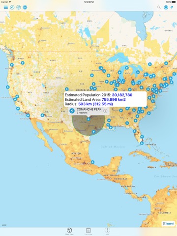
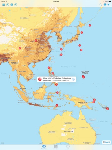
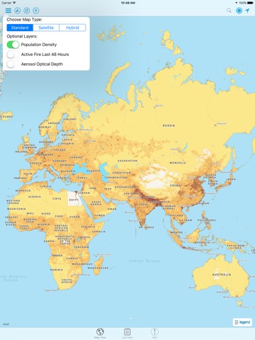
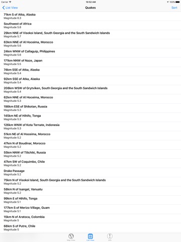
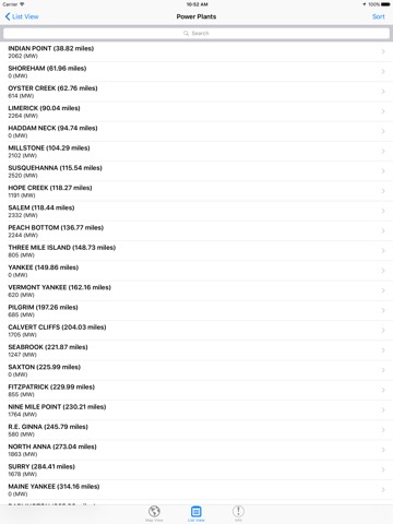
「Hazards and Population Mapper」は、NASAが配信する辞書/翻訳系アプリです。

辞書/辞典/その他

このアプリの話題とニュース

  • 新バージョン2.0が配信開始。新機能や改善アップデートがされています。


  • 2016年3月19日(土)にiPhoneとiPad両対応のユニバーサルアプリとしてリリース!


最新更新情報

version2.0が、2019年8月10日(土)にリリース

* The population estimation is now based on the new version 3.0 of the SEDAC Population Estimation Service (PES v3), which uses the latest version 4.11 of the SEDAC Population Count data set from the Gridded Population of the World (GPW) data collection.
* Added ability to display chart showing estimated population trend changes in 5-year intervals from 2000 to 2020.
* New imagery layer from NASA GIBS for display of global fires in the last 48 hours.

使い方や遊び方

Hazards and Population Mapper (HazPop) is a free app that enables users to easily display recent natural hazard data in relationship to population, major infrastructure, and satellite imagery. Hazards data include the location of active fires over the past 48 hours; earthquake alerts over the past seven days; and yesterday′s air pollution data measured from space. The app shows the location of major dams and nuclear power plants and provides more detailed information and imagery for these facilities where available. By drawing a circle around a point or area of interest on the map, users can obtain an estimate of the total population and land area enclosed within.


Developed by the NASA Socioeconomic Data and Applications Center (SEDAC) operated by the Center for International Earth Science Information Network (CIESIN) at Columbia University, HazPop combines data and map layers from various sources including NASA's Land, Atmosphere Near real-time Capability for EOS (LANCE) and Global Imagery Browse Services (GIBS), the U.S. Geological Survey (USGS), and others using a variety of open Web mapping services. The custom population estimates are provided by the SEDAC Population Estimation Service (PES) based on SEDAC′s Gridded Population of the World, version 4 (GPWv4) data for 2015.


HazPop is designed to be used by disaster risk managers, humanitarian response organizations, public health professionals, journalists, and others needing a quick assessment of the potential dangers posed by a major hazardous event or developing emergency. For example, a disaster response agency can obtain a rough estimate of the population and major facilities near a recent earthquake as an input into response planning. Journalists or students can explore the location of recent wildfires relative to dense populations, roads, terrain, and water bodies. Due to the coarse resolution and varying quality of some of the data, HazPop is not intended to support in-depth risk assessment or location-specific response needs.


HazPop supports a number of other functions including: Monitoring regions around an area of interest, e.g. hazardous area prone to natural disasters, major infrastructure, or densely populated areas; Sorting dams, nuclear power plants, or earthquakes by proximity to your location or by their characteristics; Determining the distance from your location to any point on the map or between any two points on the map.

最新ストアランキングと月間ランキング推移

Hazards and Population MapperのiPadアプリランキングや、利用者のリアルな声や国内や海外のSNSやインターネットでの人気状況を分析しています。

基本情報

仕様・スペック

対応OS
9.0 以降
容量
12.7 M
推奨年齢
全年齢
アプリ内課金
なし
更新日
2019/08/10

リリース日
2016/03/19

集客動向・アクティブユーザー分析

オーガニック流入


アクティブ率


※この結果はHazards and Population Mapperのユーザー解析データに基づいています。

利用者の属性・世代

アプリ解析デモグラフィックデータ(男女年代比率52%)

いつやるの?今でしょ!

デモグラフィックデータを元にユーザー層の性別や年齢分布などを考慮して推定しています。

ネット話題指数

開発会社の配信タイトル

このアプリと同一カテゴリのランキング

【Windows11】GemiBook XPro 14.1 ノートパソコン 8GBメモリ / 256GB SSD
CHUWI
amazon

NASA のアプリ

NASA の配信アプリ >

新着おすすめアプリ

新着おすすめアプリ >

注目まとめ

iPadアプリまとめ >