アプリオンは、世界のアプリランキングや口コミから、おすすめアプリをまとめている人気アプリ探しサイトです。

Land Nav Assistant [iPhone]

Gammon Applicationsが配信するiPhoneアプリ「Land Nav Assistant」の評価や口コミやランキング推移情報です。このアプリには「ナビゲーション」などのジャンルで分類しています。APPLIONでは「Land Nav Assistant」の他にもあなたにおすすめのアプリのレビューやみんなの評価や世界ランキングなどから探すことができます。

  • 入賞・受賞歴 月間ナビゲーション部門最高ランキング 178位を獲得!(4/27)
Land Nav Assistantのおすすめ画像1
Land Nav Assistantのおすすめ画像2
Land Nav Assistantのおすすめ画像3
Land Nav Assistantのおすすめ画像4
Land Nav Assistantのおすすめ画像5
Land Nav Assistantのおすすめ画像6
Land Nav Assistantのおすすめ画像7
<
>

Gammon Applicationsの地図/ナビアプリ

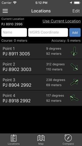
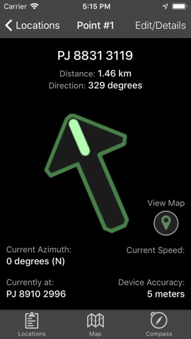
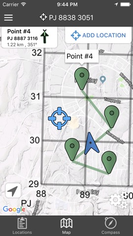
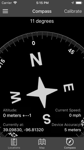
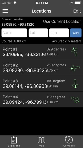
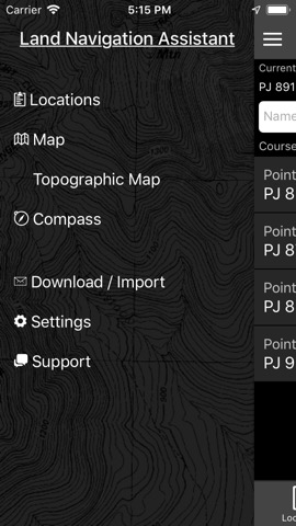
「Land Nav Assistant」は、Gammon Applicationsが配信する地図/ナビアプリです。

ナビゲーション

このアプリの話題とニュース

  • 新バージョン2.2が配信開始。新機能や改善アップデートがされています。


  • 2012年5月18日(金)にiPhoneとiPad両対応のユニバーサルアプリとしてリリース!


最新更新情報

version2.2が、2019年4月8日(月)にリリース

Draw MGRS Grid Overlays anywhere on the map (1000m, 100m)
iOS 12 Optimization
Screen improvements for iPhone X, XS, and XR

使い方や遊び方

Land Nav Assistant accepts MGRS (Military Grid) or Latitude / Longitude coordinates and visually navigates you to each point.


This app was designed with Army, Marine, and other military personnel in mind. Use it to correct your Land Nav technique by analyzing your pace count and tendency to veer left and right.


Available Input: 8 digit MGRS, 10 digit MGRS, Lat/Lon decimal, Lat/Lon dms, and map input.


Angles: degrees or mils
Distance: meters/km or feet/miles
Speed: kph or mph


Use the simple arrow interface or map to direct you to your locations. Your distance, direction, speed, and bearing are shown as you navigate.


Long-tap anywhere on the map to get the coordinate for that location. Easily add locations via the Map interface.


Plan your course by ordering points, or use the course optimization tool which will help you calculate the shortest path possible!


Get distance/direction between two points by tapping the path drawn between them.


Satellite, Terrain, Road, and basic Topographic maps show you, your locations, and lets you enter in new ones.


Overlay a 1000m or 100m MGRS grid anywhere on the map.


Displays distance/direction from your currentl location to all points, or between any two points.


Download your Locations as a spreadsheet to save anywhere, or to share with anyone you choose.


Import a large set of locations via the web import utility, available at: https://www.gammonapplications.com/land-navigation-services/import


This app uses the Military Grid Reference System (MGRS) and Latitude / Longitude.


Choose to display your locations as MGRS 10-digit, MGRS 8-digit, or LatLon Decimal.


D:M:S can be input in the format DD:MM:SS followed by the appropriate direction (NSWE). Default direction is N, W.


DO NOT use this application while learning Land Navigation. Land Navigation is a valuable skill, and should be mastered before using this application. Do not rely solely on this application for navigation, especially when lost. Always be aware of your surroundings.

紹介ムービー&プレイ動画

Land Nav Preview iPhone 5 5in

最新ストアランキングと月間ランキング推移

Land Nav AssistantのiPhoneアプリランキングや、利用者のリアルな声や国内や海外のSNSやインターネットでの人気状況を分析しています。

基本情報

仕様・スペック

対応OS
9.0 以降
容量
38.0 M
推奨年齢
全年齢
アプリ内課金
なし
更新日
2019/04/08

リリース日
2012/05/18

集客動向・アクティブユーザー分析

オーガニック流入


アクティブ率


※この結果はLand Nav Assistantのユーザー解析データに基づいています。

利用者の属性・世代

アプリ解析デモグラフィックデータ(男女年代比率52%)

ちょっ待てよ

デモグラフィックデータを元にユーザー層の性別や年齢分布などを考慮して推定しています。

ネット話題指数

開発会社の配信タイトル

このアプリと同一カテゴリのランキング

森香澄ファースト写真集 『すのかすみ。』
森香澄
amazon

新着おすすめアプリ

新着おすすめアプリ >

注目まとめ

iPhoneアプリまとめ >

ダウンロード数が多いおすすめアプリ

無料ゲームアプリランキング >