アプリオンは、世界のアプリランキングや口コミから、おすすめアプリをまとめている人気アプリ探しサイトです。
アプリオンは、世界のアプリランキングや口コミから、おすすめアプリをまとめている人気アプリ探しサイトです。
「Continental Divide Trail」は、AtlasGuidesが配信する地図/旅行アプリです。

Continental Divide Trail
AtlasGuides
無料
Android対応
旅行&地域
|
60 Trend |

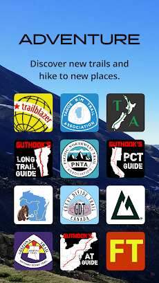
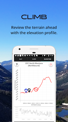

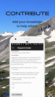
「Continental Divide Trail」は、AtlasGuidesが配信する地図/旅行アプリです。
このアプリの話題とニュース
レビュースコア4.5をマークしている高評価の優良アプリです。(4/25)
100人を超える、評価・クチコミ投稿者数となっています。(4/25)
新バージョン8.3.8が配信開始。新機能や改善アップデートがされています。
最新更新情報
version8.3.8が、2021年9月22日(水)にリリース
|
5つ星
74
4つ星
20
3つ星
4
2つ星
5
1つ星
3
|
Continental Divide TrailのAndroidアプリランキングや、利用者のリアルな声や国内や海外のSNSやインターネットでの人気状況を分析しています。
|
|
※この結果はContinental Divide Trailのユーザー解析データに基づいています。

¥1,800→¥800 : パチスロ実機シミュレーター『パチスロ 戦国コレクション5』が半額セール!
2024年04月26日 10:20

¥650→¥300 : ワイナリーのオーナーとなり、天候を見ながらぶどうを育て、熟成・醸造までを行う、ワイン造りシミュレーションゲーム『醸造物語』が半額セール!
2024年04月26日 00:25

風景写真からイラストまで、600種類以上の絵柄が掲載されている、ジグソーパズルゲーム『LINE:ジグソーパズル』が公式ストアのゲームダウンロード数で上位に
2024年04月26日 12:00

シュールで変わった問題が出てくる、謎解きクイズゲーム第4弾『最高におバカなゲーム4』へのアクセス利用数が伸びる
2024年04月24日 13:00

リヴリーという不思議な生き物を育て、箱庭の施設を拡充し住みやすい島に仕上げていく、ペット育成ゲーム『リヴリーアイランド ペットと暮らす小さな箱庭サイズの島』がネットで話題に
2024年04月24日 17:00
