アプリオンは、世界のアプリランキングや口コミから、おすすめアプリをまとめている人気アプリ探しサイトです。

T_Vas [iPhone]

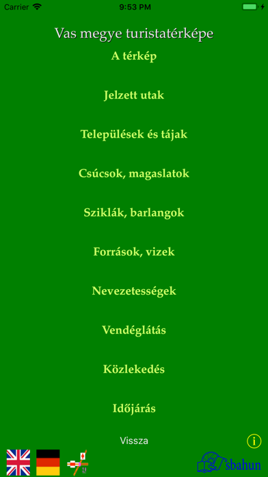
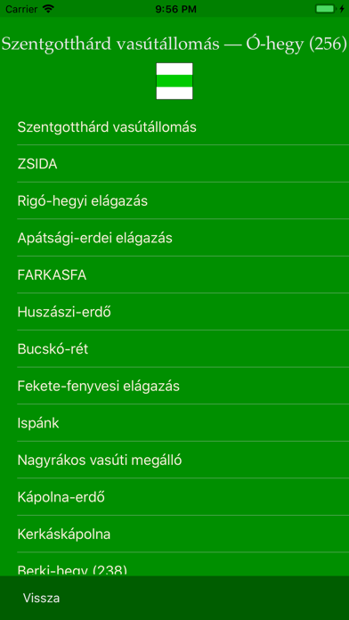
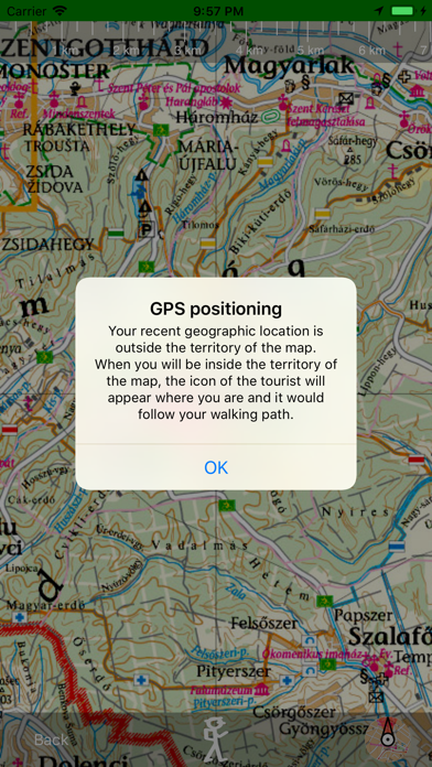
BEDŐ Árpádが配信するiPhoneアプリ「T_Vas」の評価や口コミやランキング推移情報です。このアプリには「辞書/辞典/その他」「ナビゲーション」などのジャンルで分類しています。APPLIONでは「T_Vas」の他にもあなたにおすすめのアプリのレビューやみんなの評価や世界ランキングなどから探すことができます。

現在、このアプリは非公開になっている可能性があります (探す)
T_Vasのおすすめ画像1
T_Vasのおすすめ画像2
T_Vasのおすすめ画像3
T_Vasのおすすめ画像4
T_Vasのおすすめ画像5
T_Vasのおすすめ画像6
T_Vasのおすすめ画像7
<
>

BEDŐ Árpádの辞書/翻訳系アプリ

「T_Vas」は、BEDŐ Árpádが配信する辞書/翻訳系アプリです。

辞書/辞典/その他 ナビゲーション

このアプリの話題とニュース

  • 新バージョン3.0が配信開始。新機能や改善アップデートがされています。


  • 2014年2月4日(火)にiPhoneとiPad両対応のユニバーサルアプリとしてリリース!


最新更新情報

version3.0が、2018年5月11日(金)にリリース

Alkalmazkodás a legújabb rendszerhez.
Reprogrammed for the latest system version.

使い方や遊び方

Vas megye három nyelvű turistatérképe (Magyar, angol és német nyelven használható.)


Tourist map of Vas county in three languages (Usable in Hungarian, in English and in German.)


Az alkalmazás Vas megye (a hármashatár és Kőszeg környéke kiemelésével) turistatérképét teszi használhatóvá iPad és iPhone készülékeken.


The application provides the hiking map of Vas county (with the detailed view of the three-border corner and of Kőszeg) on iPad and iPhone devices.


A térkép nagyítható és tologatható. Az égtájaknak megfelelő tájolást iránytűvel segíti. A távolság becslését skálázott vonalzó teszi lehetővé.


The map can be scaled and swiped. You may use a compass. You may use a calibrated line for distance prediction.


Az alkalmazás a GPS rendszer használatával a turista helyzetét pontosan mutatja.


Using GPS, the application shows and follows your position on the map.


Ha az Internet elérhető, az alkalmazásból közvetlenül lehet használni az időjárási adatokat és a menetrendeket.


Where Internet is available, you may use weather information and the traffic time tables.


A használati útmutatót a kezdő látvány alsó részén lévő „info” gombra tapintva lehet megtekinteni.


You get the user's guide tapping the "info" button in the main screen.


A térképjelek magyarázatát az info gombtól balra látható térképjelre tapintva lehet tanulmányozni.


The meanings of the icons of the map can be find tapping the map-icon button to the left of the info button.


A kiválasztott jelzett út címsora alatt megjelenő turistaút-jelre tapintva az alkalmazás megmutatja az útvonalat („végig megy”) az úton. Az út bemutatását megállíthatjuk és folytattathatjuk ráduplázással illetve a rögzítés feloldásával. A rátapintáskor megjelenő „Vissza” gombbal leállíthatjuk az út bemutatását.


Tapping the icon of an already selected signed path the application shows the whole path (it follows the path from the start to the end point). You may stop the animation by double tapping on the map. The animation continues after tapping the Unlock map button at the bottom. Tapping the map during animation you get the toolbar, where using the Back button you may go back to the description of the signed path.

最新ストアランキングと月間ランキング推移

T_VasのiPhoneアプリランキングや、利用者のリアルな声や国内や海外のSNSやインターネットでの人気状況を分析しています。

基本情報

仕様・スペック

対応OS
9.3 以降
容量
64.5 M
推奨年齢
全年齢
アプリ内課金
なし
更新日
2018/05/11

リリース日
2014/02/04

集客動向・アクティブユーザー分析

オーガニック流入

アクティブ率

※この結果はT_Vasのユーザー解析データに基づいています。

ネット話題指数

開発会社の配信タイトル

このアプリと同一カテゴリのランキング

浜辺美波 写真集「voyage」
浜辺美波
amazon

BEDŐ Árpád のアプリ

BEDŐ Árpád の配信アプリ >

新着おすすめアプリ

新着おすすめアプリ >

注目まとめ

iPhoneアプリまとめ >