アプリオンは、世界のアプリランキングや口コミから、おすすめアプリをまとめている人気アプリ探しサイトです。

River Thames Guide Lite [iPhone]

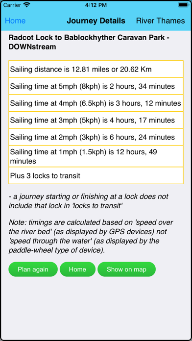
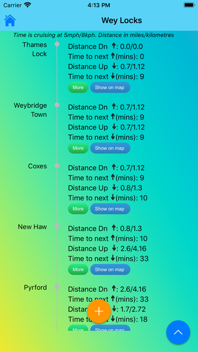
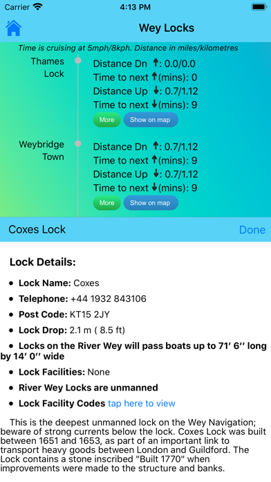
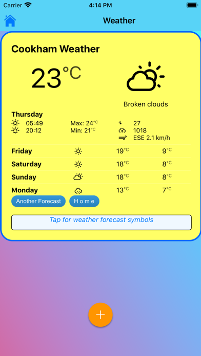
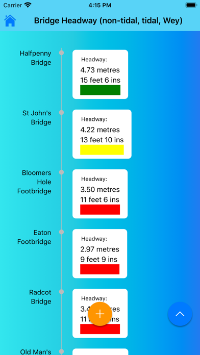
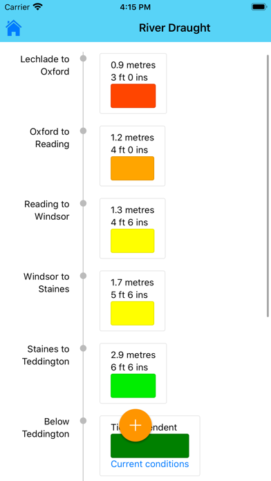
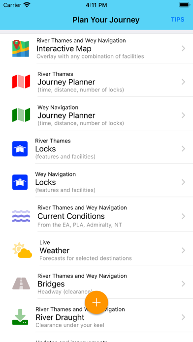
Jeff Maynardが配信するiPhoneアプリ「River Thames Guide Lite」の評価や口コミやランキング推移情報です。このアプリには「ナビゲーション」「旅行」などのジャンルで分類しています。APPLIONでは「River Thames Guide Lite」の他にもあなたにおすすめのアプリのレビューやみんなの評価や世界ランキングなどから探すことができます。

River Thames Guide Liteのおすすめ画像1
River Thames Guide Liteのおすすめ画像2
River Thames Guide Liteのおすすめ画像3
River Thames Guide Liteのおすすめ画像4
River Thames Guide Liteのおすすめ画像5
River Thames Guide Liteのおすすめ画像6
River Thames Guide Liteのおすすめ画像7
<
>

Jeff Maynardの地図/ナビアプリ

「River Thames Guide Lite」は、Jeff Maynardが配信する地図/ナビアプリです。

ナビゲーション 旅行

このアプリの話題とニュース

  • 大人の男性スマホユーザーに人気が出てきています。


  • 新バージョン24.3が配信開始。新機能や改善アップデートがされています。(3/7)


  • 2014年1月5日(日)にiPhoneとiPad両対応のユニバーサルアプリとしてリリース!


最新更新情報

version24.3が、2024年3月7日(木)にリリース

Conditions' Widgets
Three stretch widget
One stretch widget (for tidal and non-tidal)
all for iPhone, iPad, Mac

New Home Screen layout
optimised to suit user's screen size
Upgrade to back end
to improve app resilience
Improvements for small screens
information on non-tidal and Wey Navigation issues
now summarised rather than opening long agency page

使い方や遊び方

The complete planner and guide for travel and leisure on the River Thames (from its source to the Thames Barrier) and the Wey Navigation including where you can go, how you get there and what’s on the way - includes these key features:


Thames Map and Guide:
•Interactive River Map*
•Journey Planner: time (at 5, 3 , 1 mph), distance and number of locks between any two of 102 River Thames points (45 on Wey)
•Locks: need to know detail on every lock
•Bridges: headway in metres and feet
•River draught (depth of water)
•Weather for selected locations*
•Current river conditions (non-tidal and tidal)*


Boating Advice:
•Rules for the River
•Preventing Problems
•Emergency Help and Guidance (RNLI approved)


INTERACTIVE RIVER MAP*: pinch or squeeze to zoom to the required level of detail. Add any combination of locks, moorings, boatyards, fuel, marinas, pubs, restaurants, lodgings, sanitation, fishing, emergency RVP and/or bridges; tapping any icon pops up further details including phone number, post code, maximum stay etc (where available).


JOURNEY PLANNER: select a starting point and destination from the supplied list of 102 landmarks (including locks, marinas, moorings, bridges and places of interest (from Lechlade to the Thames Barrier) and immediately see the sailing distance, direction (up or downstream), sailing time (at 5 mph, 3 mph and 1 mph) and the number of locks to transit to complete your journey; Wey navigation planner features 45 locations.


LOCK FEATURES: every Thames lock is listed in order from Cricklade Bridge to Teddington with distance to next lock both up and downstream. Touch any lock to see much more information including: telephone number; post code; lock type; width, drop and length; lock keeper’s hours; facilities available (such as WC, water, pump out etc). From the lock detail just tap to highlight this lock in the middle of the interactive map. Portage Maps for Sonning to Teddington locks.


BRIDGE HEADWAY: every bridge listed in order with headway in feet and metres; bridge headways are colour coded for ease of use and instant check to see if you need to lower any masts.


WEATHER*: select one of 20 location on the river for an up-to-date weather forecast for today and tomorrow (includes temperature, winds, humidity, visibility, sunrise and sunset). Requires an Internet connection. The weather page includes the current nautical twilight (the correct time to strike your ensign).


CURRENT RIVER CONDITIONS*: for safer river use always verify the current official conditions before setting off; non-tidal conditions are provided by the Environment Agency (the River Thames authority) and categorised as Red, Yellow or Green – tap to view an explanation of the colours. Tidal conditions are provided by the Port of London Authority. Includes current and planned river closures and river restrictions.


IN CASE OF EMERGENCY: River Thames Guide includes an SOS section with information, endorsed by the RNLI, on how to deal with various problems including: Man Overboard; Boat Sinking; Boat on Fire; Boat Drifting. NOTE: these sections should be studied before embarking so that you can react properly to any emergency. Better still: take an appropriate course before using the river.


HELP: every page contains tips on using River Thames Guide to help plan your journey, find somewhere to eat or stay, using the map, and more.


* requires an active Internet connection

最新ストアランキングと月間ランキング推移

River Thames Guide LiteのiPhoneアプリランキングや、利用者のリアルな声や国内や海外のSNSやインターネットでの人気状況を分析しています。

基本情報

仕様・スペック

対応OS
11.0 以降
容量
104 M
推奨年齢
全年齢
アプリ内課金
なし
更新日
2024/03/07

リリース日
2014/01/05

集客動向・アクティブユーザー分析

オーガニック流入


アクティブ率


※この結果はRiver Thames Guide Liteのユーザー解析データに基づいています。

利用者の属性・世代

アプリ解析デモグラフィックデータ(男女年代比率66%)

ヤだねったら、ヤだね

デモグラフィックデータを元にユーザー層の性別や年齢分布などを考慮して推定しています。

ネット話題指数

開発会社の配信タイトル

このアプリと同一カテゴリのランキング

551の豚まん
551蓬莱
amazon

Jeff Maynard のアプリ

Jeff Maynard の配信アプリ >

新着おすすめアプリ

新着おすすめアプリ >

注目まとめ

iPhoneアプリまとめ >