Weather4D Routing & Navigation integrates weather forecasting, routing calculations, navigation with digitized raster charts, instruments and data sharing to maximize your boating experience.
Navigation
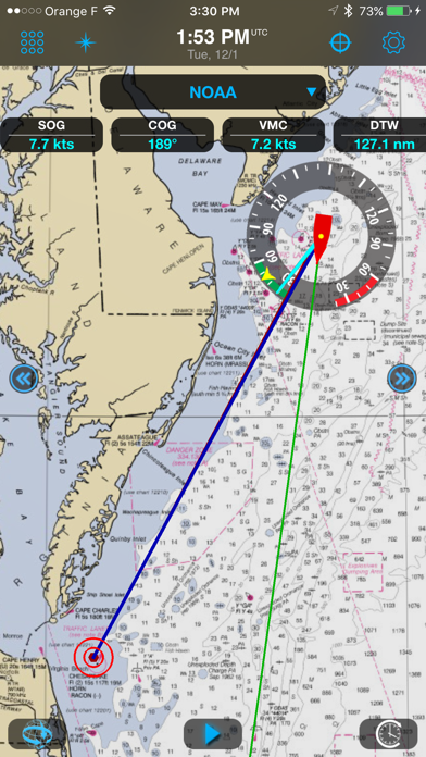
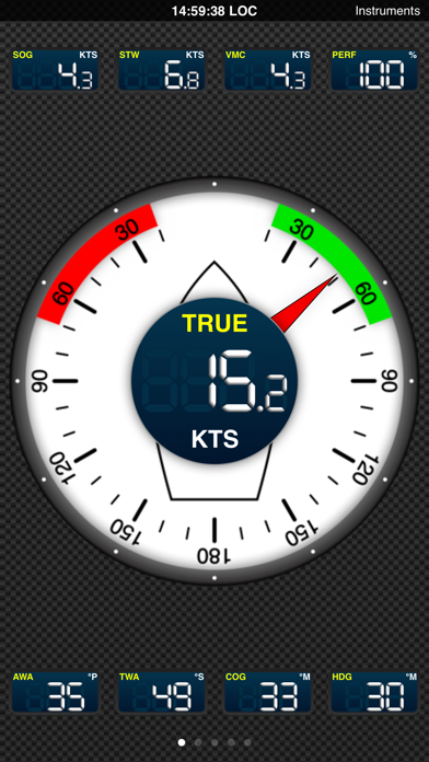
See SOG, COG, VMC, HDG, TWS, AWS, ETAs, ETWs, AIS data and more in real time along with weather and routing information with a wifi connection to a transponder.
Store your charts on your device for offshore/offline navigations.
Set the screen to night mode after sunset to better see what’s happening outside during your watch.
Set alarms to alert about excessive XTE, course deviations, surrounding boats, excessive wind speed and low depth.
Take advantage of the iPad/iPhone built in compass, pressure and acceleration sensors.
Connect bluetooth devices like wireless anemometers and wind vanes.
Share AIS and boat sensors data like wind, current, pressure, air and sea temperature within the Weather4D users community.
Activate Man Overboard safety feature to estimate drift and thus rescue location based on current and wind.
Weather
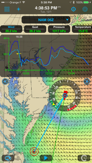
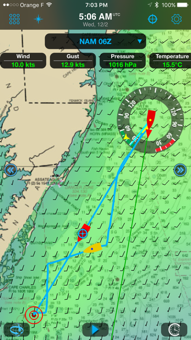
View combined weather data displayed in 3D HD layers animated automatically or manually by sliding a finger on the screen.
Use GFS model to get started. In addition, over 35 weather and oceanographic models are available with a yearly subscription (in-app purchase).
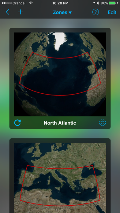
Create your own geographical zones, select the models you need and download only the characteristics that matter to you: data type, resolution, periodicity, file size, etc. GRIB files can be downloaded anywhere through a regular or satellite internet connection.
Split the screen (iPad only) to combine and/or compare: navigation and weather, weather and waves or currents, two weather models…
Routing
Routing calculation optimizes for safety, comfort and performance when sailing, motoring, or mixing the two.
Create a route and calculate its associated routings in function of departure dates/times, forecasts (weather, wave and current), minimum sailing speed, motoring speed, boat polar, maximum wind and minimum distance to the coast.
Visualize sail configurations based on your routings and your own set of sails.
Save waypoints, locations, simulate routes, combine them with GRIB forecast models.
Restart a routing calculation at anytime from the actual boat position.
Default Models and Charts
————————————
GFS global forecast model at 0.25 °, 0.5 °, 1 ° and 2 ° resolutions
BING global chart
OSM (Opens Street Map) global chart
Optional Models (GRIBs) and Nautical Charts (additional fees apply)
——————————————————————————————-
ECMWF
NAM USA
GEM Global
COAMPS Europe, West Atlantic, Central America, East Pacific
ICON-EU Europe
ARPEGE Global, Europe
AROME France, Antilles, Guyane, Polynésie, Calédonie, Indien
AROME HD France
WRF France, Europe, Greece, NW Africa, Azores, Lesser Antilles
Greater Antilles
Waves:
MFWAM Global, Europe, France
FNMOC WW3 Global, Europe
Currents:
MyOcean Global, IBI, NWS, Baltic, Med
NCOM AMSEAS, USEAST, ALASKA, SOCAL, HAWAII
Nautical Charts:
GeoGarage is Weather4D supplier and offers by subscription access to more than 10,000 nautical charts derived from International Hydrographic Services. Pricing and chart selection is set per publisher. Updates are released regularly under chart publishers authority. Once the subscription is purchased, charts are instantly accessible within the application.
Available publishers:
NOAA RNCs (USA)
CHS (Canada)
WAVEYLINE (Bahamas)
DHNV (Venezuela)
DHN (Brazil)
SHN (Argentina)
LINZ (New Zealand)
SHOM (France / DOM-TOM / Polynesia + international)
UKHO (UK and dependencies + international)
BSH (Germany)
NLHO (Netherlands)
VLAAMSE (Belgium)
DGA (Denmark)
NHS (Norway)
ICG-HD (Iceland)
NAVIMAP / IIM (Italy)
ENC_ES (Spain)
ENC_HR (Croatia)
BLP (West Mexico)
IMRAY (North Sea, English Channel, West Britain & Ireland, Atlantic France, Iberia & Atlantic Islands, Western Mediterranean, Central Mediterranean, East Mediterranean, Netherlands)
GeoCuba (Cuba)