An app to satisfy all your Fishing and Boating's needs, developed with the help of expert boaters. Download the best up-to-date Nautical Charts to safely enjoy the new boating season. With the Aqua Map Master transform your device in a real ChartPlotter.
►► Features:
• Optimised for both iPhone and iPad
• Download the maps on the device for offline usage
• Plan and navigate your ROUTE with real-time information on next waypoint
• Anchor alarm with advanced configuration
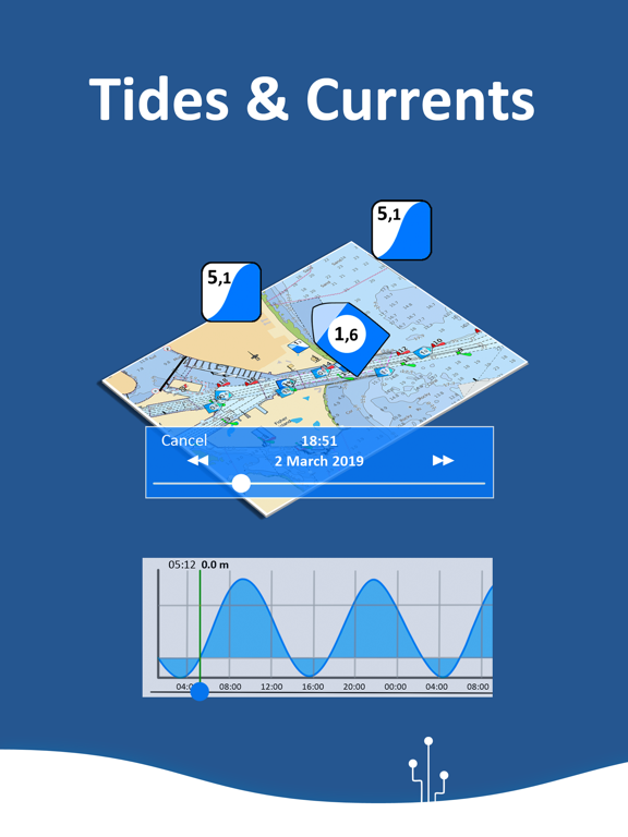
• Tides & Currents prediction and simulation
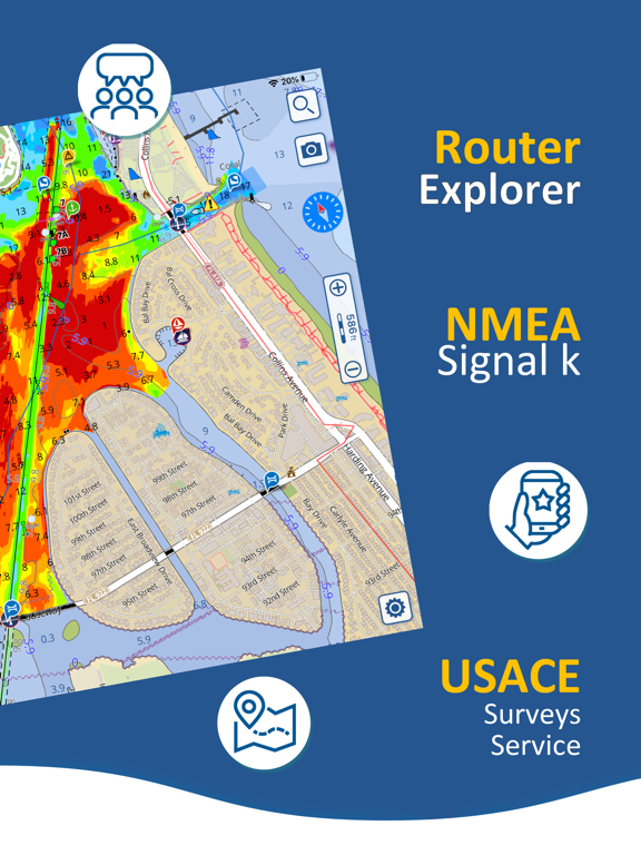
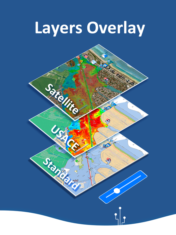
• Overlay the USACE surveys on top of your charts
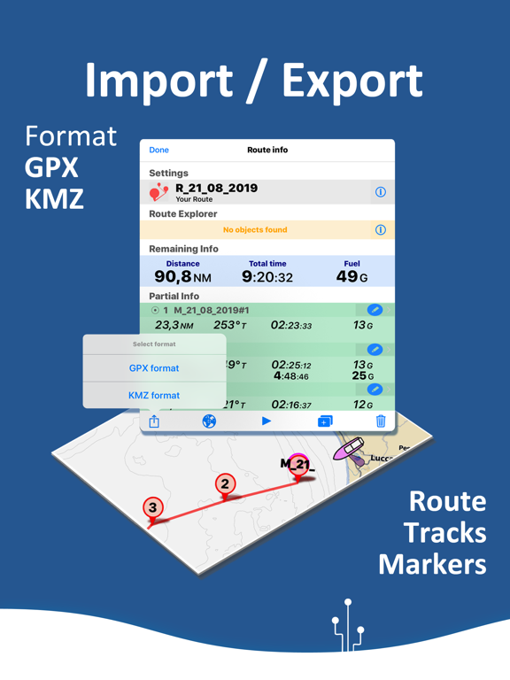
• Share and load tracks, markers and routes (KMZ and GPX)
• ActiveCaptain & Waterway Guide community integration
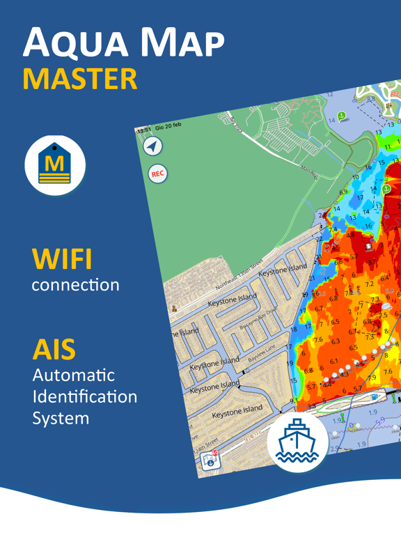
• Connect your NMEA devices through WiFi
• Display AIS info from external devices with automatic collision detection
• Powerful search with advanced settings
• Use the bird view to better see what in front of you
• Overlay the Satellite images on your map
• Fully support iOS 13 Dark/Light aspect
• Measure distances on the map
• Check all the bridges, hazards and best fuel prices along your route
• Query map objects at your finger tip
• Works perfectly in iPad multi-screen mode
• Optimized battery usage
► MAPS
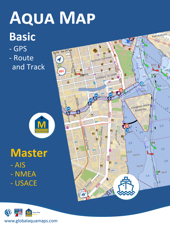
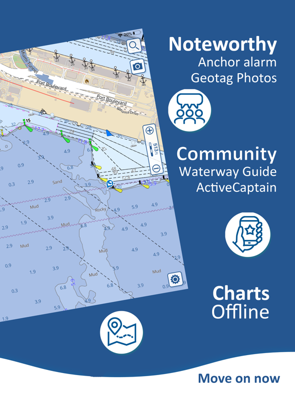
Aqua Map lets you download - No additional purchases!!! - the best US Nautical charts (from NOAA), the US Major Rivers (from USACE) with depth contours, buoys, lights, etc. plus more than 12000 lakes maps with contours. A complete land chart with roads, tracks, and important places is also included. You can download the maps at home within your device and then use them on the boat without any Internet connection.
► ROUTES and WAYPOINTS
Plan your trip, insert and edit waypoints. Navigate your route and monitor distance, time (ETA) and direction toward your next waypoint or your final destination.
► ANCHOR ALARM
This function will check in realtime your GPS position against your anchor position previously defined. An acoustic and visual alarm will run as soon as your GPS position is out of the preferred range.
► TIDES & CURRENTS
You can calculate the prediction for more than 6800 stations in the US & Canada. You can also have a simulation of the T&C trend on the map.
► LOADING and SHARING
You can share your favorite's markers on Facebook or send an email with your last daily track. Not only, you can also load any KML, KMZ, GPX (also zipped) found in internet or received from your friends.
► ActiveCaptain
Join the community of more than 100.000 boaters who write reviews, update data and provide up to date hazard information.
Read and contribute reviews and rating about marinas, shared local boating knowledge, anchorage and hazards
► Waterway Guide
Marinas, hazards, anchorages, bridges, free docks and much more to cover the entire US coastline.
► Aqua Map Master
With this subscription you will access a set of advanced functions that will transform your device in a real ChartPlotter (.. and more).
Connect your NMEA (and SignalK) devices through the WiFi and use their data for all the App functions (eg Anchor Alarm), download and display the last USACE surveys, consult the Route Explorer with bridges, hazards and best fuel prices calculation, display the AIS targets on the map with automatic collision detection.
► TYPE OF PURCHASES
- Unlimited: you can download and update your charts forever.
- Subscription: it is a one year auto-renewable subscription, it will automatically renews unless auto-renew is turned off at least 24-hours before the end of the current period. Subscriptions may be managed by the user and auto-renewal may be turned off by going to the user's Account Settings after purchase.
Terms of Service: http://www.globalaquamaps.com/Acknowledge.html
Privacy Policy: http://www.gec-it.com/GEC-privacy.pdf
————
The continuous GPS usage, also in background, can drastically reduce the battery life.