アプリオンは、世界のアプリランキングや口コミから、おすすめアプリをまとめている人気アプリ探しサイトです。
アプリオンは、世界のアプリランキングや口コミから、おすすめアプリをまとめている人気アプリ探しサイトです。

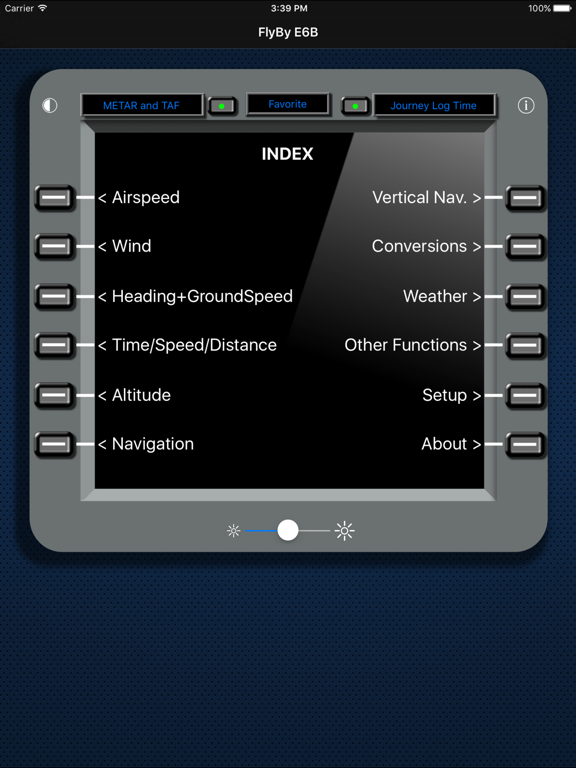
FlyBy E6B
Lonnie Ganz
¥2,400
iPhone / iPad対応
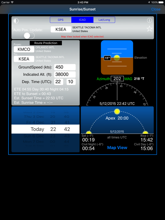
ナビゲーション
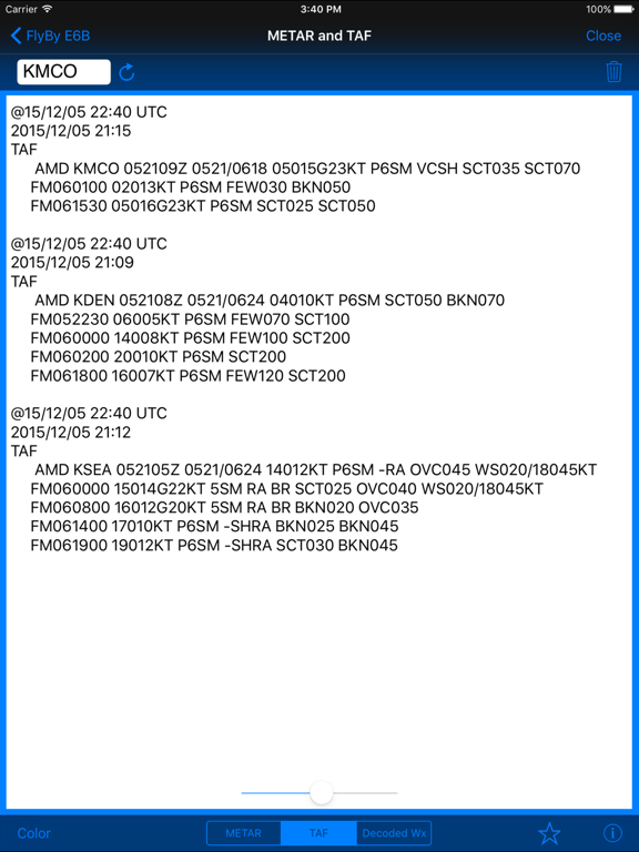
天気
64bit
|
60 Trend |

このアプリの話題とニュース
新バージョン2023.38が配信開始。新機能や改善アップデートがされています。(10/20)
2010年6月22日(火)にiPhoneとiPad両対応のユニバーサルアプリとしてリリース!
最新更新情報
version2023.38が、2023年10月20日(金)にリリース
- Fixed METAR/TAF NOAA data connection.
- Removed METAR/TAF Decoded option.
|
|
FlyBy E6BのiPadアプリランキングや、利用者のリアルな声や国内や海外のSNSやインターネットでの人気状況を分析しています。
|
|
※この結果はFlyBy E6Bのユーザー解析データに基づいています。

¥1,200→¥700 : 雄大で幻想的な砂漠の世界を、サンドスキーで走り抜ける、美麗アートワークで描かれた、横スクロールアクションゲーム『アルトのオデッセイ(Alto's Odyssey)』が期間限定値下げ!
2024年04月16日 17:25

【新作】森に住む魔女となり、魔法の材料を集めてポーションを作り、偏屈な人間や強欲な生き物をこらしめていく、クラフトアドベンチャーゲーム『ウィッチウッド(Wytchwood)』のiOS版が配信開始!
2024年04月16日 21:00

フライパンに乗ったベーコンをひっくり返し、様々なオブジェクトの上にきちんと乗せる、ネタ系カジュアルゲーム『Bacon』がネットで取り上げられ話題に
2024年04月13日 12:00

街にある公園やスーパーなどで、商品やアイテムを取って自由に遊べる、街遊びゲーム『Dr. Pandaタウン物語』が子どもやファミリー層に人気に
2024年04月14日 10:00

【新作】魔法使いの塔に立たせ、強化した魔法力で、遅い来る敵を殲滅していく、タワーディフェンスゲーム『サバイバル·ランダム·ディフェンス』のiOS版がリリース!
2024年04月16日 17:00