アプリオンは、世界のアプリランキングや口コミから、おすすめアプリをまとめている人気アプリ探しサイトです。
アプリオンは、世界のアプリランキングや口コミから、おすすめアプリをまとめている人気アプリ探しサイトです。
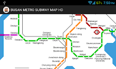
「BUSAN METRO SUBWAY MAP HD」は、iMap Placeが配信する地図/旅行アプリです。

BUSAN METRO SUBWAY MAP HD
iMap Place
無料
Android対応
旅行&地域
|
60 Trend |


「BUSAN METRO SUBWAY MAP HD」は、iMap Placeが配信する地図/旅行アプリです。
このアプリの話題とニュース
20代の女性層に人気の傾向にあります。
最新更新情報
version1.09が、2013年6月5日(水)にリリース
|
5つ星
7
4つ星
0
3つ星
1
2つ星
0
1つ星
1
|
BUSAN METRO SUBWAY MAP HDのAndroidアプリランキングや、利用者のリアルな声や国内や海外のSNSやインターネットでの人気状況を分析しています。
|
|
※この結果はBUSAN METRO SUBWAY MAP HDのユーザー解析データに基づいています。

水墨画で描かれた世界を、忍となり超高速に走り抜けながら、敵を斬って突き進む、爽快横スクロールバトルアクションゲーム『忍者マストダイ』が無料ゲームの注目トレンドに
2024年07月24日 19:00

撮った写真を動画化して、美しいシネマグラフが簡単に作れるアプリ『Motionleap:Lightricksの写真アニメーター』が無料アプリのマーケットトレンドに
2024年07月25日 11:00

【新作】永遠のヒーローとなるべく、スキルを強化しフィールドを闊歩するモンスターを殲滅し、強く育成していく、見下ろし型3DアクションRPG『エターナルヒーロー』のAndroid版がリリース!
2024年07月25日 16:00

【新作】音声ベースで会話できる、おしゃべりAI『Cotomo(コトモ)』のAndroid版がリリース!
2024年07月25日 08:00

工具を強化し、鉱山労働者を雇ってチーム編成し、金やダイヤモンドなど功績や資源を採掘していく、ドット絵鉱業現場経営シミュレーションゲーム『アイドル洞窟マイナー』がネットで話題に
2024年07月26日 12:00


