アプリオンは、世界のアプリランキングや口コミから、おすすめアプリをまとめている人気アプリ探しサイトです。
アプリオンは、世界のアプリランキングや口コミから、おすすめアプリをまとめている人気アプリ探しサイトです。
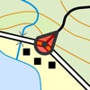
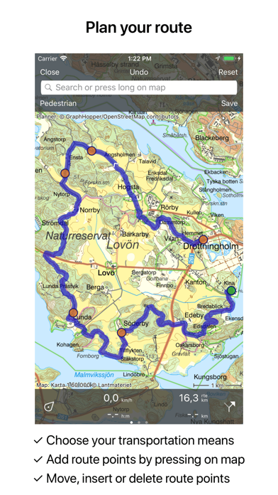
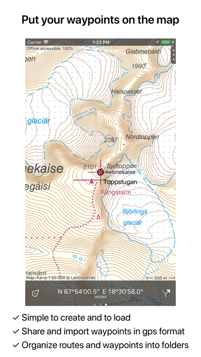
rdzlが配信するiPhoneアプリ「Topo GPS Sweden」の評価や口コミやランキング推移情報です。このアプリには「ナビゲーション」「旅行」などのジャンルで分類しています。APPLIONでは「Topo GPS Sweden」の他にもあなたにおすすめのアプリのレビューやみんなの評価や世界ランキングなどから探すことができます。


このアプリの話題とニュース
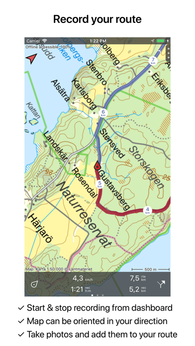
新バージョン5.8.4が配信開始。新機能や改善アップデートがされています。
2016年3月18日(金)にiPhoneとiPad両対応のユニバーサルアプリとしてリリース!
最新更新情報
version5.8.4が、2019年6月29日(土)にリリース
5.8.4: Fix of a critical bug that prevented closing a popup when not connected to Wi-Fi.
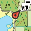
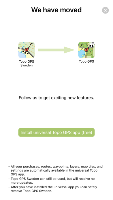
We have moved from Topo GPS Sweden to a new universal Topo GPS app.
Please install this update so that your data and purchases will be transferred automatically. If you start the updated app you will be guided to our new app.
Topo GPS Sweden can still be used, but will receive no more updates.
Topo GPS SwedenのiPhoneアプリランキングや、利用者のリアルな声や国内や海外のSNSやインターネットでの人気状況を分析しています。
|
|
※この結果はTopo GPS Swedenのユーザー解析データに基づいています。
1位: Belgium topographic map 1 year (1480円)
2位: 36 km² of Belgium (120円)
3位: 3600 km² of Belgium (9000円)
4位: 360 km² of Belgium (980円)
5位: Topographic map of Denmark (400円)
6位: Topographic map of Finland (400円)
7位: OpenStreetMap world map (400円)
8位: Topographic map of Norway (400円)
9位: Topographic map of Netherlands (400円)
10位: Topographic map New Zealand (400円)

¥2,600→¥1,600 : 三国時代の君主となり、武将を率いて大陸統一を目指す、短時間で遊べる英雄バトルロードなども新搭載した、三国志シミュレーションゲーム『三國志Ⅴ』が期間限定値下げ!
2024年04月24日 23:25

スマホを面会ガラスに見立て、孤島に囚われた囚人を、監視カメラで監視しながら、彼の閉ざされた記憶と心を取り戻す、体験恋愛ゲーム続編『囚われのパルマ Refrain』が面白いと人気が出始めている模様
2024年04月21日 20:00

物理演算で計算されたオープンワールドの世界で、ふにゃふにゃの人間を動かし、壁を超えたり砲台を使ったりしながら、ギミックあふれる奇妙な世界から抜け出す、パズルアクションゲーム『ヒューマン フォール フラット』が人気ゲームとしてブレイク中!
2024年04月22日 21:00

左右反転やビフォーアフター写真の見比べもできる、自顔撮影に特化したミラーカメラ『BAミラー』がAppStoreのストアダウンロードを大きく伸ばす
2024年04月22日 11:00

パチンコ玉を打ち出して、ブロックを崩した量が攻撃力となる、ブロック崩しパズルバトルRPG『Peglin(ペグリン)』がネットで取り上げられ話題に
2024年04月24日 16:00