アプリオンは、世界のアプリランキングや口コミから、おすすめアプリをまとめている人気アプリ探しサイトです。
アプリオンは、世界のアプリランキングや口コミから、おすすめアプリをまとめている人気アプリ探しサイトです。

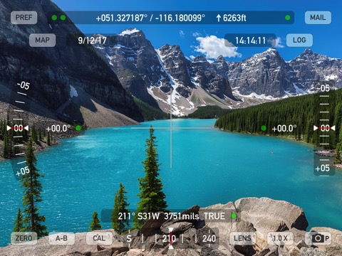
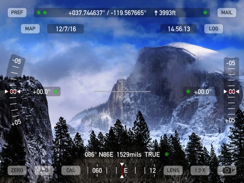
Theodolite HD
Craig Hunter
¥1,300
iPad専用
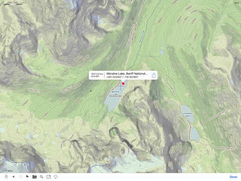
ナビゲーション
写真/ビデオ
64bit
|
87 Trend |


このアプリの話題とニュース
新バージョン9.0.3が配信開始。新機能や改善アップデートがされています。(9/23)
2011年3月15日(火)にiPad版がリリース!
最新更新情報
version9.0.3が、2023年9月23日(土)にリリース
Fix for graphics glitches affecting some devices on iOS 17.
|
5つ星
0
4つ星
0
3つ星
0
2つ星
1
1つ星
0
|
Theodolite HDのiPadアプリランキングや、利用者のリアルな声や国内や海外のSNSやインターネットでの人気状況を分析しています。
|
|
※この結果はTheodolite HDのユーザー解析データに基づいています。
1位: World Datum Pack (400円)
2位: 10,000 Outdoors Map Tiles (1300円)
3位: 5,000 Outdoors Map Tiles (700円)
4位: 1,000 Outdoors Map Tiles (100円)
5位: US Mountain Summits AR Layer (400円)
6位: 20,000 Outdoors Map Tiles (2500円)
7位: US State Plane Coordinates (3500円)
8位: Team Tracking (300円)
![]()
いつやるの?今でしょ!
※デモグラフィックデータを元にユーザー層の性別や年齢分布などを考慮して推定しています。

¥400→¥100 : 庭にまいた種から不思議なストーリーが展開する、ポイントクリック型アドベンチャーゲーム『Rusty Lake: Roots』が75%オフの大幅値下げ!
2024年04月20日 02:25

¥400→¥200 : らくらく操作で安全運転!『オービス』が半額セール!
2024年04月19日 14:15

小学校の社会の授業で学ぶ地図記号を、選択式のクイズ形式で楽しく学べる、地図記号学習アプリ『地図記号クイズ』がネットで取り上げられ話題に
2024年04月18日 14:00

【新作】スーパーに並べる商品の発注から陳列、レジ対応までを行っていく、スーパーマーケットマネイジメントゲーム『スーパーマーケットのマネージャーシミュレーター』のiOS版がリリース!
2024年04月17日 18:00

ひたすらタップして、クッキーを作り上げていく、クッキークリッカー系タップゲーム『Cookies! 』がネットで取り上げられ話題に
2024年04月17日 12:00